Street Plan Collection (#2)

"Exploring the Streets of Old London

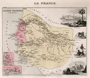
Background imageStreet Plan Collection: Africa Francaise, Senegal - France and its Colonies. Atlas illustrates one hundred
Africa Francaise, Senegal - France and its Colonies. Atlas illustrates one hundred
XEE4144393 Africa Francaise, Senegal - France and its Colonies. Atlas illustrates one hundred and five maps from the maps of the depot of war, bridges and footwear and the Navy by M. VUILLEMIN. 1876

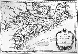
Background imageStreet Plan Collection: Map of Acadia (Canada) c. 1760 (engraving)

Map of Acadia (Canada) c. 1760 (engraving)
1721743 Map of Acadia (Canada) c. 1760 (engraving) by French School, (19th century); (add.info.: Map of Acadia (Canada) c. 1760, engraving)

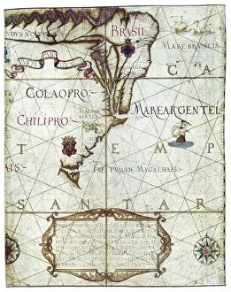
Background imageStreet Plan Collection: Map of South America, in Universa ac Navigabilis Totius Terrarum Orbis Descriptio 1559

Map of South America, in Universa ac Navigabilis Totius Terrarum Orbis Descriptio 1559 (colour manuscript)
AIS5334419 Map of South America, in Universa ac Navigabilis Totius Terrarum Orbis Descriptio 1559 (colour manuscript) by Homem, Andre (16th century); Bibliotheque Nationale, Paris

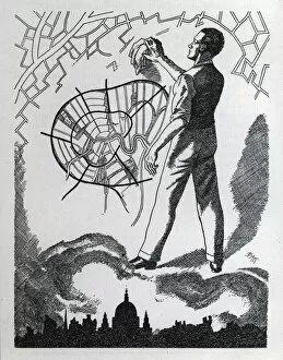
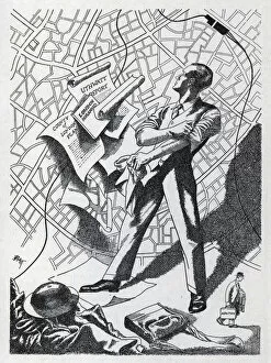
Background imageStreet Plan Collection: Vision (litho)

Vision (litho)
7150306 Vision (litho) by Barrett, Oswald Charles (BATT) (1892-1945); Private Collection; (add.info.: Vision. Illustration from How Should We Rebuild London)

Background imageStreet Plan Collection: Purpose (litho)

Purpose (litho)
7150294 Purpose (litho) by Barrett, Oswald Charles (BATT) (1892-1945); Private Collection; (add.info.: PurposeIllustration from How Should We Rebuild London)

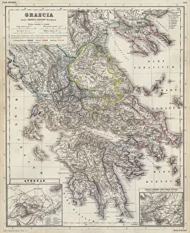
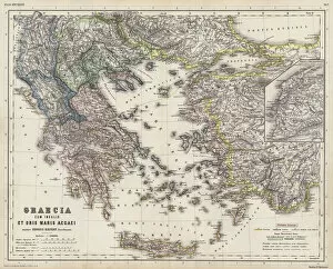
Background imageStreet Plan Collection: Map of Ancient Greece (coloured engraving)

Map of Ancient Greece (coloured engraving)
7148250 Map of Ancient Greece (coloured engraving) by Kiepert, Heinrich (1818-99); Private Collection; (add.info.: Map of Ancient Greece)

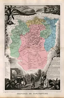
Background imageStreet Plan Collection: Department of Constantine, French Algeria. - France and its Colonies. Atlas illustrates one hundred

Department of Constantine, French Algeria. - France and its Colonies. Atlas illustrates one hundred
XEE4144396 Department of Constantine, French Algeria. - France and its Colonies. Atlas illustrates one hundred and five maps from the maps of the depot of war, bridges and footwear and the Navy by M

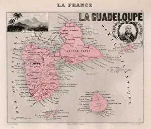
Background imageStreet Plan Collection: La Guadeloupe (overseas department or overseas department) - France and its Colonies

La Guadeloupe (overseas department or overseas department) - France and its Colonies
XEE4144387 La Guadeloupe (overseas department or overseas department) - France and its Colonies. Atlas illustrates one hundred and five maps from the maps of the depot of war

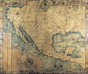
Background imageStreet Plan Collection: Map of New Spain (North America), 1767, addressed to Cardinal

Map of New Spain (North America), 1767, addressed to Cardinal and Inquisitor General Francisco Antonio de Lorenzana
AIS5348838 Map of New Spain (North America), 1767, addressed to Cardinal and Inquisitor General Francisco Antonio de Lorenzana

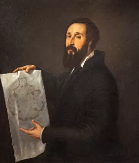
Background imageStreet Plan Collection: Portrait of Giulio Romano, 1536

Portrait of Giulio Romano, 1536
7240519 Portrait of Giulio Romano, 1536 by Titian (Tiziano Vecellio) (c.1488-1576); Palazzo del Te, Mantua, Italy; (add.info.: Palazzo Te (Gonzagas summer residence)); Ghigo Roli

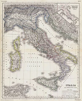
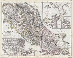
Background imageStreet Plan Collection: Map of Italy in the time before the Romans (coloured engraving)

Map of Italy in the time before the Romans (coloured engraving)
7148251 Map of Italy in the time before the Romans (coloured engraving) by Kiepert, Heinrich (1818-99); Private Collection; (add.info.: Map of Italy in the time before the Romans)

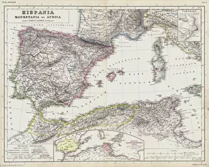
Background imageStreet Plan Collection: Map of the Roman provinces of Hispania, Mauretania and Africa (coloured engraving)

Map of the Roman provinces of Hispania, Mauretania and Africa (coloured engraving)
7148256 Map of the Roman provinces of Hispania, Mauretania and Africa (coloured engraving) by Kiepert, Heinrich (1818-99); Private Collection; (add.info.: Map of the Roman provinces of Hispania)

Background imageStreet Plan Collection: Map of Italy in the time before the Romans (coloured engraving)

Map of Italy in the time before the Romans (coloured engraving)
7148253 Map of Italy in the time before the Romans (coloured engraving) by Kiepert, Heinrich (1818-99); Private Collection; (add.info.: Map of Italy in the time before the Romans)

Background imageStreet Plan Collection: Map of Ancient Greece (coloured engraving)

Map of Ancient Greece (coloured engraving)
7148249 Map of Ancient Greece (coloured engraving) by Kiepert, Heinrich (1818-99); Private Collection; (add.info.: Map of Ancient Greece)

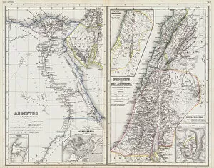
Background imageStreet Plan Collection: Maps of Ancient Egypt, Phoenicia and Palestine (coloured engraving)

Maps of Ancient Egypt, Phoenicia and Palestine (coloured engraving)
7148247 Maps of Ancient Egypt, Phoenicia and Palestine (coloured engraving) by Kiepert, Heinrich (1818-99); Private Collection; (add.info.: Maps of Ancient Egypt, Phoenicia and Palestine)

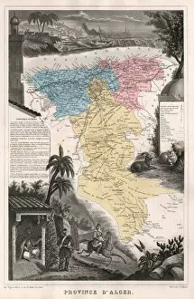
Background imageStreet Plan Collection: Department of Algiers, French Algeria - France and its Colonies. Atlas illustrates one hundred

Department of Algiers, French Algeria - France and its Colonies. Atlas illustrates one hundred
XEE4144398 Department of Algiers, French Algeria - France and its Colonies. Atlas illustrates one hundred and five maps from the maps of the depot of war, bridges and footwear and the Navy by M

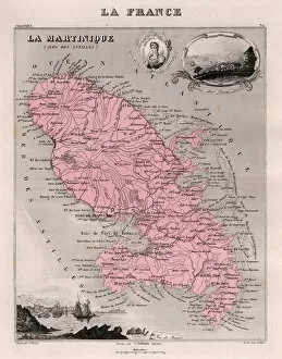
Background imageStreet Plan Collection: Martinique (overseas department or overseas department) - France and its Colonies

Martinique (overseas department or overseas department) - France and its Colonies
XEE4144385 Martinique (overseas department or overseas department) - France and its Colonies. Atlas illustrates one hundred and five maps from the maps of the depot of war

Background imageStreet Plan Collection: Inertia (litho)

Inertia (litho)
7150303 Inertia (litho) by Barrett, Oswald Charles (BATT) (1892-1945); Private Collection; (add.info.: Inertia. Illustration from How Should We Rebuild London)

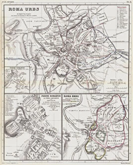
Background imageStreet Plan Collection: Maps of the city of Rome in ancient times (coloured engraving)

Maps of the city of Rome in ancient times (coloured engraving)
7148254 Maps of the city of Rome in ancient times (coloured engraving) by Kiepert, Heinrich (1818-99); Private Collection; (add.info.: Maps of the city of Rome in ancient times)

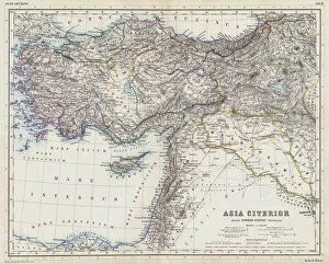
Background imageStreet Plan Collection: Map of the Near East in ancient times (coloured engraving)

Map of the Near East in ancient times (coloured engraving)
7148248 Map of the Near East in ancient times (coloured engraving) by Kiepert, Heinrich (1818-99); Private Collection; (add.info.: Map of the Near East in ancient times)

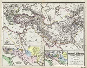
Background imageStreet Plan Collection: Maps of the ancient Persian and Macedonian empires (coloured engraving)

Maps of the ancient Persian and Macedonian empires (coloured engraving)
7148246 Maps of the ancient Persian and Macedonian empires (coloured engraving) by Kiepert, Heinrich (1818-99); Private Collection; (add.info.: Maps of the ancient Persian and Macedonian empires)

Background imageStreet Plan Collection: Algeria, French Africa - France and its Colonies. Atlas illustrates one hundred

Algeria, French Africa - France and its Colonies. Atlas illustrates one hundred
XEE4144403 Algeria, French Africa - France and its Colonies. Atlas illustrates one hundred and five maps from the maps of the depot of war, bridges and footwear and the Navy by M. VUILLEMIN. 1876

Background imageStreet Plan Collection: Department of Oran, French Algeria. Oran, Geryville, Tlemcen, Arzew, Mazagran

Department of Oran, French Algeria. Oran, Geryville, Tlemcen, Arzew, Mazagran. - France and its Colonies
XEE4144397 Department of Oran, French Algeria. Oran, Geryville, Tlemcen, Arzew, Mazagran. - France and its Colonies. Atlas illustrates one hundred and five maps from the maps of the depot of war

Background imageStreet Plan Collection: An apartment in the Palais-Royal, Paris. 1778 (engraving)

An apartment in the Palais-Royal, Paris. 1778 (engraving)
7233216 An apartment in the Palais-Royal, Paris. 1778 (engraving) by Benard, Robert (fl.1734); Private Collection; (add.info.: An apartment in the Palais-Royal, Paris)

Background imageStreet Plan Collection: 1899 map of South Africa during Second Boer War (colour engraving)

1899 map of South Africa during Second Boer War (colour engraving)
7239667 1899 map of South Africa during Second Boer War (colour engraving) by Unknown Artist, (19th century); Private Collection; (add.info)

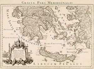
Background imageStreet Plan Collection: Map of ancient Greece and part of Turkey (engraving)

Map of ancient Greece and part of Turkey (engraving)
7239665 Map of ancient Greece and part of Turkey (engraving) by Delisle, Guillaume (1675-1726) (after); Private Collection; (add.info.: Graeciae pars meridionalis. Graeciae antiquae tabula nova)

Background imageStreet Plan Collection: Decimus Burtons Plan of the Ground (litho)

Decimus Burtons Plan of the Ground (litho)
7172048 Decimus Burtons Plan of the Ground (litho) by English School, (20th century); Private Collection; (add.info.: Decimus Burtons Plan of the Ground)

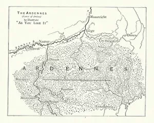
Background imageStreet Plan Collection: Shakespeare: Map to illustrate As You Like It (litho)

Shakespeare: Map to illustrate As You Like It (litho)
7171962 Shakespeare: Map to illustrate As You Like It (litho) by English School, (19th century); Private Collection; (add.info.: Map to illustrate As You Like It)

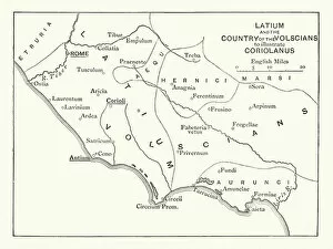
Background imageStreet Plan Collection: Shakespeare: Map to illustrate Coriolanus (litho)

Shakespeare: Map to illustrate Coriolanus (litho)
7171905 Shakespeare: Map to illustrate Coriolanus (litho) by English School, (19th century); Private Collection; (add.info.: Map to illustrate Coriolanus)

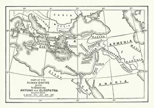
Background imageStreet Plan Collection: Shakespeare: Map to illustrate Antony and Cleopatra (litho)

Shakespeare: Map to illustrate Antony and Cleopatra (litho)
7171900 Shakespeare: Map to illustrate Antony and Cleopatra (litho) by English School, (19th century); Private Collection; (add.info.: Map to illustrate Antony and Cleopatra)

Background imageStreet Plan Collection: Plan of the city of Beijing, China (coloured engraving)

Plan of the city of Beijing, China (coloured engraving)
7148372 Plan of the city of Beijing, China (coloured engraving) by European School, (19th century); Private Collection; (add.info.: Plan of the city of Beijing, China)

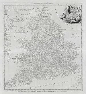
Background imageStreet Plan Collection: Map of the counties of England and Wales (engraving)

Map of the counties of England and Wales (engraving)
7147405 Map of the counties of England and Wales (engraving) by English School, (18th century); Private Collection; (add.info.: Map of the counties of England and Wales)

Background imageStreet Plan Collection: Schoolboys in a classroom dressed up as cowboys (colour litho)

Schoolboys in a classroom dressed up as cowboys (colour litho)
7157497 Schoolboys in a classroom dressed up as cowboys (colour litho) by English School, (20th century); Private Collection; (add.info.: Schoolboys in a classroom dressed up as cowboys)

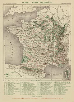
Background imageStreet Plan Collection: France, Carte des Forets (engraving)

France, Carte des Forets (engraving)
7158179 France, Carte des Forets (engraving) by French School, (19th century); Private Collection; (add.info.: France, Carte des Forets)

Background imageStreet Plan Collection: Carte Topographique de la Lune (engraving)

Carte Topographique de la Lune (engraving)
7158169 Carte Topographique de la Lune (engraving) by French School, (19th century); Private Collection; (add.info.: Carte Topographique de la Lune)

Background imageStreet Plan Collection: Air Routes of Central Europe (colour litho)

Air Routes of Central Europe (colour litho)
7163168 Air Routes of Central Europe (colour litho) by English School, (20th century); Private Collection; (add.info.: Air Routes of Central Europe)

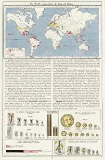
Background imageStreet Plan Collection: The Worlds Commodities, 5 Sugar and Pepper (colour litho)

The Worlds Commodities, 5 Sugar and Pepper (colour litho)
7169515 The Worlds Commodities, 5 Sugar and Pepper (colour litho) by English School, (20th century); Private Collection; (add.info.: The Worlds Commodities, 5 Sugar and Pepper)

Background imageStreet Plan Collection: Industrial North America with Communications (colour litho)

Industrial North America with Communications (colour litho)
7169505 Industrial North America with Communications (colour litho) by English School, (20th century); Private Collection; (add.info.: Industrial North America with Communications)

Background imageStreet Plan Collection: The British Empire showing the Great Commercial Highways (colour litho)

The British Empire showing the Great Commercial Highways (colour litho)
7169494 The British Empire showing the Great Commercial Highways (colour litho) by English School, (20th century); Private Collection; (add.info)

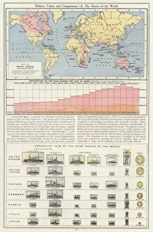
Background imageStreet Plan Collection: Relative Values and Comparisons, 4 The Navies of the World (colour litho)

Relative Values and Comparisons, 4 The Navies of the World (colour litho)
7169530 Relative Values and Comparisons, 4 The Navies of the World (colour litho) by English School, (20th century); Private Collection; (add.info.: Relative Values and Comparisons)

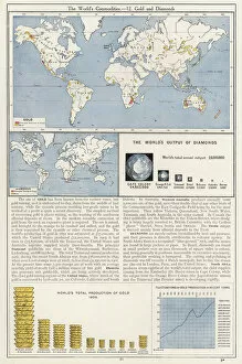
Background imageStreet Plan Collection: The Worlds Commodities, 12 Gold and Diamonds (colour litho)

The Worlds Commodities, 12 Gold and Diamonds (colour litho)
7169522 The Worlds Commodities, 12 Gold and Diamonds (colour litho) by English School, (20th century); Private Collection; (add.info.: The Worlds Commodities, 12 Gold and Diamonds)

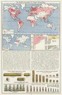
Background imageStreet Plan Collection: The Worlds Commodities, 11 Timber, Oil and Palms (colour litho)

The Worlds Commodities, 11 Timber, Oil and Palms (colour litho)
7169521 The Worlds Commodities, 11 Timber, Oil and Palms (colour litho) by English School, (20th century); Private Collection; (add.info.: The Worlds Commodities, 11 Timber, Oil and Palms)

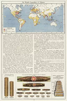
Background imageStreet Plan Collection: The Worlds Commodities, 7 Tobacco (colour litho)

The Worlds Commodities, 7 Tobacco (colour litho)
7169517 The Worlds Commodities, 7 Tobacco (colour litho) by English School, (20th century); Private Collection; (add.info.: The Worlds Commodities, 7 Tobacco)

Background imageStreet Plan Collection: The Charing Cross Region about 1592 (litho)

The Charing Cross Region about 1592 (litho)
7179951 The Charing Cross Region about 1592 (litho) by English School, (19th century); Private Collection; (add.info.: The Charing Cross Region about 1592)

Background imageStreet Plan Collection: Plan de Tell-el-Amarna (engraving)

Plan de Tell-el-Amarna (engraving)
7179866 Plan de Tell-el-Amarna (engraving) by French School, (19th century); Private Collection; (add.info.: Plan de Tell-el-Amarna)

Background imageStreet Plan Collection: Plan of the particular disposition of the Histrionic Portraits, at Ivy Cottage, Kentish Town

Plan of the particular disposition of the Histrionic Portraits, at Ivy Cottage, Kentish Town
7179131 Plan of the particular disposition of the Histrionic Portraits, at Ivy Cottage, Kentish Town, Collected by the late Mr Charles Mathews and now in the Possession of the Garrick Club (engraving)

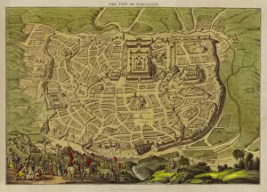
Background imageStreet Plan Collection: Map of the city of Jerusalem (colour litho)

Map of the city of Jerusalem (colour litho)
7172922 Map of the city of Jerusalem (colour litho) by English School, (19th century); Private Collection; (add.info.: Map of the city of Jerusalem)

Background imageStreet Plan Collection: The journeyings of the Israelites from Egypt to Canaan (engraving)

The journeyings of the Israelites from Egypt to Canaan (engraving)
7192908 The journeyings of the Israelites from Egypt to Canaan (engraving) by English School, (19th century); Private Collection; (add.info.: The journeyings of the Israelites from Egypt to Canaan)


For sale as Licensed Images

Choose your image, Select your licence and Download the media

"Exploring the Streets of Old London: A Glimpse into the City's Past" Step back in time with these fascinating street plans that offer a captivating glimpse into the history of London. Delve into the past with an old street map of Bethnal Green and Hackney from 1908, revealing the intricate layout of these vibrant neighborhoods. Travel further east to The Isle of Dogs and discover how it looked in 1908, as you navigate its streets alongside the majestic River Thames at Greenwich. Uncover a hidden gem in Warwickshire with a village plan of Kineton dating back to 1885-1887, showcasing its quaint charm through an unknown creator's artistic vision. Dive beneath the surface as you explore sewer depths in the City of London from 1944, presented vividly through a colorful lithograph that reveals this crucial infrastructure. Journey northwards to Hamstead, Holloway, and Islington using an old street map from 1908; witness how these areas have evolved over time while retaining their unique character. Immerse yourself in grandeur as you traverse The Strand and West End on an exquisite street map from 1908; marvel at its architectural splendor while tracing your steps along the River Thames. Transport yourself to Victorian-era London with engravings depicting iconic routes such as Finsbury Circus to "Angel" Islington via City Road (1888), Euston Road to Paddington via Marylebone Road (1888), and Tottenham Court Road to Camden Town via Hampstead Road (1888). Admire Burlington House on Piccadilly through Johannes Kip's early 18th-century artwork (1908); get lost in its timeless beauty amidst one of London's most prestigious locations.