Street Plan Collection (#3)

"Exploring the Streets of Old London

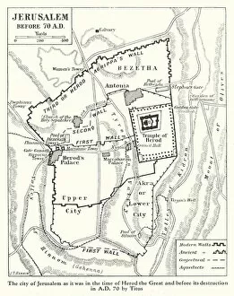
Background imageStreet Plan Collection: Map of Jerusalem in the time of Herod the Great, 1st Century (litho)

Map of Jerusalem in the time of Herod the Great, 1st Century (litho)
7201942 Map of Jerusalem in the time of Herod the Great, 1st Century (litho) by English School, (20th century); Private Collection; (add.info.: Map of Jerusalem in the time of Herod the Great)

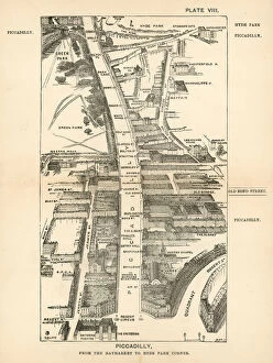
Background imageStreet Plan Collection: London in 1888: Piccadilly, from the Haymarket to Hyde Park Corner (engraving)

London in 1888: Piccadilly, from the Haymarket to Hyde Park Corner (engraving)
7188735 London in 1888: Piccadilly, from the Haymarket to Hyde Park Corner (engraving) by English School, (19th century); Private Collection; (add.info.: Piccadilly)

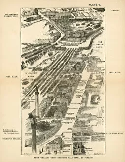
Background imageStreet Plan Collection: London in 1888: From Charing Cross through Pall Mall to Pimlico (engraving)

London in 1888: From Charing Cross through Pall Mall to Pimlico (engraving)
7188732 London in 1888: From Charing Cross through Pall Mall to Pimlico (engraving) by English School, (19th century); Private Collection; (add.info.: From Charing Cross through Pall Mall to Pimlico)

Background imageStreet Plan Collection: Map of the Lake District (litho)

Map of the Lake District (litho)
7160437 Map of the Lake District (litho) by English School, (20th century); Private Collection; (add.info.: Map of the Lake District)

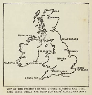
Background imageStreet Plan Collection: Map of the stations in the United Kingdom and Irish Free State which are used for ships

Map of the stations in the United Kingdom and Irish Free State which are used for ships communications (litho)
7158880 Map of the stations in the United Kingdom and Irish Free State which are used for ships communications (litho) by English School

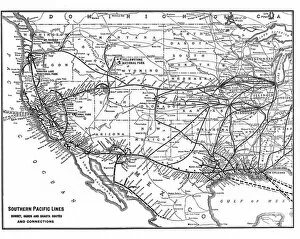
Background imageStreet Plan Collection: Southern Pacific Lines, Sunset, Ogden and Shasta Routes and Connections (litho)

Southern Pacific Lines, Sunset, Ogden and Shasta Routes and Connections (litho)
7198825 Southern Pacific Lines, Sunset, Ogden and Shasta Routes and Connections (litho) by American School, (20th century); Private Collection; (add.info.: Southern Pacific Lines, Sunset)

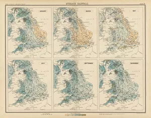
Background imageStreet Plan Collection: Royal Atlas, c 1900: Average Rainfall (colour litho)

Royal Atlas, c 1900: Average Rainfall (colour litho)
7198200 Royal Atlas, c 1900: Average Rainfall (colour litho) by English School, (20th century); Private Collection; (add.info.: Average Rainfall)

Background imageStreet Plan Collection: Royal Atlas, c 1900: Average Temperature (colour litho)

Royal Atlas, c 1900: Average Temperature (colour litho)
7198199 Royal Atlas, c 1900: Average Temperature (colour litho) by English School, (20th century); Private Collection; (add.info.: Average Temperature)

Background imageStreet Plan Collection: Royal Atlas, c 1900: Parliamentary Representation (colour litho)

Royal Atlas, c 1900: Parliamentary Representation (colour litho)
7198196 Royal Atlas, c 1900: Parliamentary Representation (colour litho) by English School, (20th century); Private Collection; (add.info.: Parliamentary Representation)

Background imageStreet Plan Collection: Royal Atlas, c 1900: Density of Population (colour litho)

Royal Atlas, c 1900: Density of Population (colour litho)
7198195 Royal Atlas, c 1900: Density of Population (colour litho) by English School, (20th century); Private Collection; (add.info.: Density of Population)

Background imageStreet Plan Collection: Royal Atlas, c 1900: Counties and Boroughs (colour litho)

Royal Atlas, c 1900: Counties and Boroughs (colour litho)
7198193 Royal Atlas, c 1900: Counties and Boroughs (colour litho) by English School, (20th century); Private Collection; (add.info.: Counties and Boroughs)

Background imageStreet Plan Collection: Royal Atlas, c 1900: Central London (colour litho)

Royal Atlas, c 1900: Central London (colour litho)
7198210 Royal Atlas, c 1900: Central London (colour litho) by English School, (20th century); Private Collection; (add.info.: Central London)

Background imageStreet Plan Collection: Railway junctions around Willesden and Acton Wells, London (litho)

Railway junctions around Willesden and Acton Wells, London (litho)
7201175 Railway junctions around Willesden and Acton Wells, London (litho) by English School, (20th century); Private Collection; (add.info.: Railway junctions around Willesden and Acton Wells)

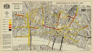
Background imageStreet Plan Collection: Pedestrian traffic on streets in the City of London, 1939 (colour litho)

Pedestrian traffic on streets in the City of London, 1939 (colour litho)
7201424 Pedestrian traffic on streets in the City of London, 1939 (colour litho) by English School, (20th century); Private Collection; (add.info)

Background imageStreet Plan Collection: Map of the Roman Empire at its greatest extent, 119 (litho)

Map of the Roman Empire at its greatest extent, 119 (litho)
7200988 Map of the Roman Empire at its greatest extent, 119 (litho) by English School, (19th century); Private Collection; (add.info.: Map of the Roman Empire at its greatest extent, 119)

Background imageStreet Plan Collection: Shakespeare: Map to illustrate Twelfth Night (litho)

Shakespeare: Map to illustrate Twelfth Night (litho)
7171966 Shakespeare: Map to illustrate Twelfth Night (litho) by English School, (19th century); Private Collection; (add.info.: Map to illustrate Twelfth Night)

Background imageStreet Plan Collection: Shakespeare: Map to illustrate King Henry V (litho)

Shakespeare: Map to illustrate King Henry V (litho)
7171952 Shakespeare: Map to illustrate King Henry V (litho) by English School, (19th century); Private Collection; (add.info.: Map to illustrate King Henry V)

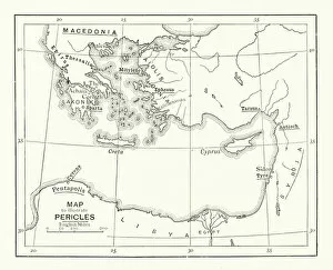
Background imageStreet Plan Collection: Shakespeare: Map to illustrate Pericles, Prince of Tyre (litho)

Shakespeare: Map to illustrate Pericles, Prince of Tyre (litho)
7171874 Shakespeare: Map to illustrate Pericles, Prince of Tyre (litho) by English School, (19th century); Private Collection; (add.info.: Map to illustrate Pericles, Prince of Tyre)

Background imageStreet Plan Collection: Shakespeare: Map to illustrate Timon of Athens (litho)

Shakespeare: Map to illustrate Timon of Athens (litho)
7171786 Shakespeare: Map to illustrate Timon of Athens (litho) by English School, (19th century); Private Collection; (add.info.: Map to illustrate Timon of Athens)

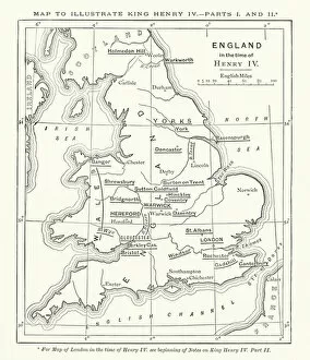
Background imageStreet Plan Collection: Shakespeare: Map to illustrate King Henry IV, Parts 1 and 2 (litho)

Shakespeare: Map to illustrate King Henry IV, Parts 1 and 2 (litho)
7171944 Shakespeare: Map to illustrate King Henry IV, Parts 1 and 2 (litho) by English School, (19th century); Private Collection; (add.info.: Map to illustrate King Henry IV, Parts 1 and 2)

Background imageStreet Plan Collection: France Physique (engraving)

France Physique (engraving)
7158181 France Physique (engraving) by French School, (19th century); Private Collection; (add.info.: France Physique. Illustration for Dictionnaire Francais Illustre des Mots et des Choses by MM)

Background imageStreet Plan Collection: Anciennes Provinces de la France (engraving)

Anciennes Provinces de la France (engraving)
7158178 Anciennes Provinces de la France (engraving) by French School, (19th century); Private Collection; (add.info.: Anciennes Provinces de la France)

Background imageStreet Plan Collection: Monde Grec Ancien (engraving)

Monde Grec Ancien (engraving)
7158175 Monde Grec Ancien (engraving) by French School, (19th century); Private Collection; (add.info.: Monde Grec Ancien)

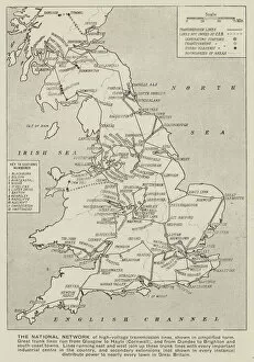
Background imageStreet Plan Collection: British national network of high-voltage electric power lines (litho)

British national network of high-voltage electric power lines (litho)
7157609 British national network of high-voltage electric power lines (litho) by English School, (20th century); Private Collection; (add.info)

Background imageStreet Plan Collection: Map of the Western Front at the beginning of the Allied offensive on the Somme, France

Map of the Western Front at the beginning of the Allied offensive on the Somme, France, World War I, July 1916 (litho)
7172515 Map of the Western Front at the beginning of the Allied offensive on the Somme, France, World War I, July 1916 (litho) by English School

Background imageStreet Plan Collection: Map of Africa (engraving)

Map of Africa (engraving)
7165215 Map of Africa (engraving) by English School, (19th century); Private Collection; (add.info.: Map of Africa, showing the routes of the principal explorers)

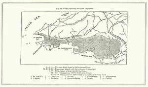
Background imageStreet Plan Collection: Map of Wales, showing the Coal Deposits (engraving)

Map of Wales, showing the Coal Deposits (engraving)
7165959 Map of Wales, showing the Coal Deposits (engraving) by English School, (19th century); Private Collection; (add.info.: Map of Wales, showing the Coal Deposits)

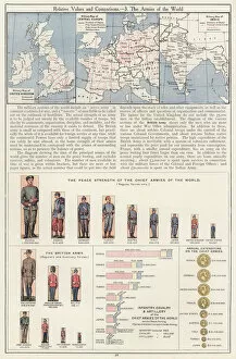
Background imageStreet Plan Collection: Relative Values and Comparisons, 3 The Armies of the World (colour litho)

Relative Values and Comparisons, 3 The Armies of the World (colour litho)
7169529 Relative Values and Comparisons, 3 The Armies of the World (colour litho) by English School, (20th century); Private Collection; (add.info.: Relative Values and Comparisons)

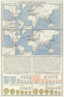
Background imageStreet Plan Collection: The Worlds Commodities, 13 Silver and Copper (colour litho)

The Worlds Commodities, 13 Silver and Copper (colour litho)
7169523 The Worlds Commodities, 13 Silver and Copper (colour litho) by English School, (20th century); Private Collection; (add.info.: The Worlds Commodities, 13 Silver and Copper)

Background imageStreet Plan Collection: The Worlds Commodities, 9 Cotton, Flax and Hemp (colour litho)

The Worlds Commodities, 9 Cotton, Flax and Hemp (colour litho)
7169519 The Worlds Commodities, 9 Cotton, Flax and Hemp (colour litho) by English School, (20th century); Private Collection; (add.info.: The Worlds Commodities, 9 Cotton, Flax and Hemp)

Background imageStreet Plan Collection: The Worlds Commodities, 1 Meat (colour litho)

The Worlds Commodities, 1 Meat (colour litho)
7169511 The Worlds Commodities, 1 Meat (colour litho) by English School, (20th century); Private Collection; (add.info.: The Worlds Commodities, 1 Meat)

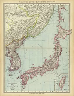
Background imageStreet Plan Collection: The Japanese Empire, including Korea and Sakhalin (colour litho)

The Japanese Empire, including Korea and Sakhalin (colour litho)
7169503 The Japanese Empire, including Korea and Sakhalin (colour litho) by English School, (20th century); Private Collection; (add.info.: The Japanese Empire, including Korea and Sakhalin)

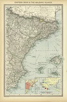
Background imageStreet Plan Collection: Eastern Spain and the Balearic Islands (colour litho)

Eastern Spain and the Balearic Islands (colour litho)
7169495 Eastern Spain and the Balearic Islands (colour litho) by English School, (20th century); Private Collection; (add.info.: Eastern Spain and the Balearic Islands)

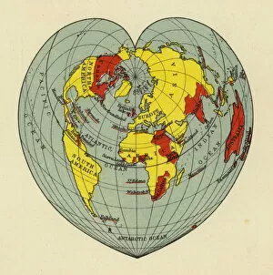
Background imageStreet Plan Collection: The British Empire shown on a heart-shaped map of the world (colour litho)

The British Empire shown on a heart-shaped map of the world (colour litho)
7169491 The British Empire shown on a heart-shaped map of the world (colour litho) by English School, (20th century); Private Collection; (add.info)

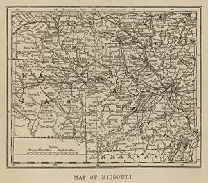
Background imageStreet Plan Collection: Map of Missouri (engraving)

Map of Missouri (engraving)
7170612 Map of Missouri (engraving) by American School, (19th century); Private Collection; (add.info.: Map of Missouri. Illustration for The Southern States of North America)

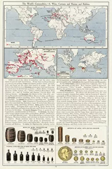
Background imageStreet Plan Collection: The Worlds Commodities, 6 Wine, Currants and Raisins and Rubber (colour litho)

The Worlds Commodities, 6 Wine, Currants and Raisins and Rubber (colour litho)
7169516 The Worlds Commodities, 6 Wine, Currants and Raisins and Rubber (colour litho) by English School, (20th century); Private Collection; (add.info.: The Worlds Commodities, 6 Wine)

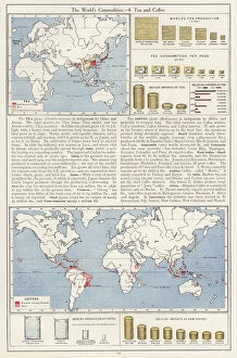
Background imageStreet Plan Collection: The Worlds Commodities, 4 Tea and Coffee (colour litho)

The Worlds Commodities, 4 Tea and Coffee (colour litho)
7169514 The Worlds Commodities, 4 Tea and Coffee (colour litho) by English School, (20th century); Private Collection; (add.info.: The Worlds Commodities, 4 Tea and Coffee)

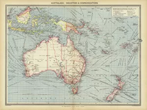
Background imageStreet Plan Collection: Australasia, Industries and Communications (colour litho)

Australasia, Industries and Communications (colour litho)
7169509 Australasia, Industries and Communications (colour litho) by English School, (20th century); Private Collection; (add.info.: Australasia, Industries and Communications)

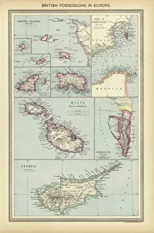
Background imageStreet Plan Collection: British Possessions in Europe (colour litho)

British Possessions in Europe (colour litho)
7169498 British Possessions in Europe (colour litho) by English School, (20th century); Private Collection; (add.info.: British Possessions in Europe)

Background imageStreet Plan Collection: North America (coloured engraving)

North America (coloured engraving)
7159915 North America (coloured engraving) by English School, (19th century); Private Collection; (add.info.: North America)

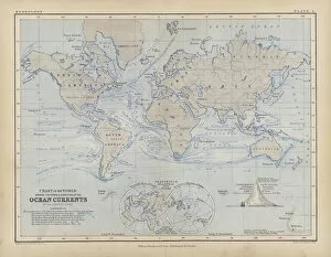
Background imageStreet Plan Collection: Ocean Currents (coloured engraving)

Ocean Currents (coloured engraving)
7159909 Ocean Currents (coloured engraving) by English School, (19th century); Private Collection; (add.info.: Ocean Currents)

Background imageStreet Plan Collection: Map of Regents Park and Primrose Hill (litho)

Map of Regents Park and Primrose Hill (litho)
7163735 Map of Regents Park and Primrose Hill (litho) by English School, (20th century); Private Collection; (add.info.: Map of Regents Park and Primrose Hill)

Background imageStreet Plan Collection: Races of Man (coloured engraving)

Races of Man (coloured engraving)
7159925 Races of Man (coloured engraving) by English School, (19th century); Private Collection; (add.info.: Races of Man)

Background imageStreet Plan Collection: Earthquakes and Volcanoes (coloured engraving)

Earthquakes and Volcanoes (coloured engraving)
7159919 Earthquakes and Volcanoes (coloured engraving) by English School, (19th century); Private Collection; (add.info.: Earthquakes and Volcanoes)

Background imageStreet Plan Collection: The British Isles (coloured engraving)

The British Isles (coloured engraving)
7159917 The British Isles (coloured engraving) by English School, (19th century); Private Collection; (add.info.: The British Isles)

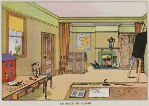
Background imageStreet Plan Collection: The classroom (chromolitho)

The classroom (chromolitho)
7148666 The classroom (chromolitho) by English School, (20th century); Private Collection; (add.info.: The classroom. Illustration from Le Livre Rouge, by E Magee (Blackie & Son Limited)

Background imageStreet Plan Collection: The known world to Europeans before the voyage of Christopher Columbus in 1492 (litho)

The known world to Europeans before the voyage of Christopher Columbus in 1492 (litho)
7148523 The known world to Europeans before the voyage of Christopher Columbus in 1492 (litho) by English School, (20th century); Private Collection; (add.info)

Background imageStreet Plan Collection: Map of the known world by Herodotus, c450 BC (engraving)

Map of the known world by Herodotus, c450 BC (engraving)
7173433 Map of the known world by Herodotus, c450 BC (engraving) by German School, (19th century); Private Collection; (add.info.: Map of the known world by the Ancient Greek historian Herodotus)


For sale as Licensed Images

Choose your image, Select your licence and Download the media

"Exploring the Streets of Old London: A Glimpse into the City's Past" Step back in time with these fascinating street plans that offer a captivating glimpse into the history of London. Delve into the past with an old street map of Bethnal Green and Hackney from 1908, revealing the intricate layout of these vibrant neighborhoods. Travel further east to The Isle of Dogs and discover how it looked in 1908, as you navigate its streets alongside the majestic River Thames at Greenwich. Uncover a hidden gem in Warwickshire with a village plan of Kineton dating back to 1885-1887, showcasing its quaint charm through an unknown creator's artistic vision. Dive beneath the surface as you explore sewer depths in the City of London from 1944, presented vividly through a colorful lithograph that reveals this crucial infrastructure. Journey northwards to Hamstead, Holloway, and Islington using an old street map from 1908; witness how these areas have evolved over time while retaining their unique character. Immerse yourself in grandeur as you traverse The Strand and West End on an exquisite street map from 1908; marvel at its architectural splendor while tracing your steps along the River Thames. Transport yourself to Victorian-era London with engravings depicting iconic routes such as Finsbury Circus to "Angel" Islington via City Road (1888), Euston Road to Paddington via Marylebone Road (1888), and Tottenham Court Road to Camden Town via Hampstead Road (1888). Admire Burlington House on Piccadilly through Johannes Kip's early 18th-century artwork (1908); get lost in its timeless beauty amidst one of London's most prestigious locations.