Street Plan Collection (#5)

"Exploring the Streets of Old London

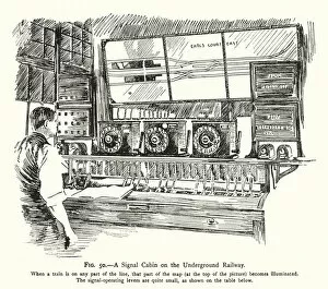
Background imageStreet Plan Collection: A Signal Cabin on the Underground Railway (colour litho)

A Signal Cabin on the Underground Railway (colour litho)
7166340 A Signal Cabin on the Underground Railway (colour litho) by English School, (20th century); Private Collection; (add.info.: A Signal Cabin on the Underground Railway)

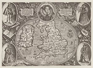
Background imageStreet Plan Collection: Old Map of England (litho)

Old Map of England (litho)
7166065 Old Map of England (litho) by European School, (19th century); Private Collection; (add.info.: Old Map of England)

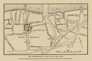
Background imageStreet Plan Collection: Site of Shakespeares Globe Theatre, Southwark, London (litho)

Site of Shakespeares Globe Theatre, Southwark, London (litho)
7172908 Site of Shakespeares Globe Theatre, Southwark, London (litho) by English School, (20th century); Private Collection; (add.info.: Site of Shakespeares Globe Theatre, Southwark, London)

Background imageStreet Plan Collection: The Worlds Commodities, 14 Coal and Petroleum (colour litho)

The Worlds Commodities, 14 Coal and Petroleum (colour litho)
7169524 The Worlds Commodities, 14 Coal and Petroleum (colour litho) by English School, (20th century); Private Collection; (add.info.: The Worlds Commodities, 14 Coal and Petroleum)

Background imageStreet Plan Collection: The Worlds Commodities, 10 Silk and Leather (colour litho)

The Worlds Commodities, 10 Silk and Leather (colour litho)
7169520 The Worlds Commodities, 10 Silk and Leather (colour litho) by English School, (20th century); Private Collection; (add.info.: The Worlds Commodities, 10 Silk and Leather)

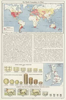
Background imageStreet Plan Collection: The Worlds Commodities, 8 Wool (colour litho)

The Worlds Commodities, 8 Wool (colour litho)
7169518 The Worlds Commodities, 8 Wool (colour litho) by English School, (20th century); Private Collection; (add.info.: The Worlds Commodities, 8 Wool)

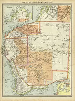
Background imageStreet Plan Collection: Western Australia, showing the Goldfields (colour litho)

Western Australia, showing the Goldfields (colour litho)
7169510 Western Australia, showing the Goldfields (colour litho) by English School, (20th century); Private Collection; (add.info.: Western Australia, showing the Goldfields)

Background imageStreet Plan Collection: South America, Industries and Communications (colour litho)

South America, Industries and Communications (colour litho)
7169507 South America, Industries and Communications (colour litho) by English School, (20th century); Private Collection; (add.info.: South America, Industries and Communications)

Background imageStreet Plan Collection: Relative Values and Comparisons, 6 The Worlds Railways (colour litho)

Relative Values and Comparisons, 6 The Worlds Railways (colour litho)
7169531 Relative Values and Comparisons, 6 The Worlds Railways (colour litho) by English School, (20th century); Private Collection; (add.info.: Relative Values and Comparisons)

Background imageStreet Plan Collection: West Indies and Central America, Industries and Communications (colour litho)

West Indies and Central America, Industries and Communications (colour litho)
7169506 West Indies and Central America, Industries and Communications (colour litho) by English School, (20th century); Private Collection; (add.info.: West Indies and Central America)

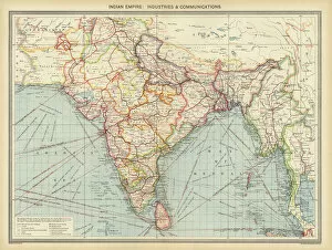
Background imageStreet Plan Collection: Indian Empire, Industries and Communications (colour litho)

Indian Empire, Industries and Communications (colour litho)
7169499 Indian Empire, Industries and Communications (colour litho) by English School, (20th century); Private Collection; (add.info.: Indian Empire, Industries and Communications)

Background imageStreet Plan Collection: Royal Atlas, c 1900: Harrogate; Scarborough (colour litho)

Royal Atlas, c 1900: Harrogate; Scarborough (colour litho)
7198229 Royal Atlas, c 1900: Harrogate; Scarborough (colour litho) by English School, (20th century); Private Collection; (add.info.: Harrogate; Scarborough)

Background imageStreet Plan Collection: Royal Atlas, c 1900: London (colour litho)

Royal Atlas, c 1900: London (colour litho)
7198218 Royal Atlas, c 1900: London (colour litho) by English School, (20th century); Private Collection; (add.info.: London)

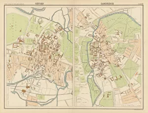
Background imageStreet Plan Collection: Royal Atlas, c 1900: Oxford; Cambridge (colour litho)

Royal Atlas, c 1900: Oxford; Cambridge (colour litho)
7198216 Royal Atlas, c 1900: Oxford; Cambridge (colour litho) by English School, (20th century); Private Collection; (add.info.: Oxford; Cambridge)

Background imageStreet Plan Collection: Royal Atlas, c 1900: Playmouth and Devonport (colour litho)

Royal Atlas, c 1900: Playmouth and Devonport (colour litho)
7198217 Royal Atlas, c 1900: Playmouth and Devonport (colour litho) by English School, (20th century); Private Collection; (add.info.: Playmouth and Devonport)

Background imageStreet Plan Collection: Royal Atlas, c 1900: Newcastle; Hull (colour litho)

Royal Atlas, c 1900: Newcastle; Hull (colour litho)
7198214 Royal Atlas, c 1900: Newcastle; Hull (colour litho) by English School, (20th century); Private Collection; (add.info.: Newcastle; Hull)

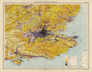
Background imageStreet Plan Collection: Royal Atlas, c 1900: Population, London Environs (colour litho)

Royal Atlas, c 1900: Population, London Environs (colour litho)
7198211 Royal Atlas, c 1900: Population, London Environs (colour litho) by English School, (20th century); Private Collection; (add.info.: Population, London Environs)

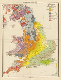
Background imageStreet Plan Collection: Royal Atlas, c 1900: Geological Features (colour litho)

Royal Atlas, c 1900: Geological Features (colour litho)
7198197 Royal Atlas, c 1900: Geological Features (colour litho) by English School, (20th century); Private Collection; (add.info.: Geological Features)

Background imageStreet Plan Collection: Abbey of Saint-Ouen, Rouen, France (engraving)

Abbey of Saint-Ouen, Rouen, France (engraving)
7185127 Abbey of Saint-Ouen, Rouen, France (engraving) by French School, (19th century); Private Collection; (add.info.: Abbey of Saint-Ouen, Rouen, France)

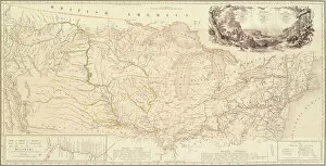
Background imageStreet Plan Collection: Map to Illustrate the Route of Prince Maximilian of Wied in the Interior of North America

Map to Illustrate the Route of Prince Maximilian of Wied in the Interior of North America from Boston to the Upper
5054760 Map to Illustrate the Route of Prince Maximilian of Wied in the Interior of North America from Boston to the Upper Missouri, 1839 (engraving) by Bodmer, Karl (1809-93); Joslyn Museum, Omaha

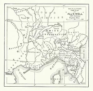
Background imageStreet Plan Collection: Shakespeare: Map to illustrate Alls Well That Ends Well (litho)

Shakespeare: Map to illustrate Alls Well That Ends Well (litho)
7171969 Shakespeare: Map to illustrate Alls Well That Ends Well (litho) by English School, (19th century); Private Collection; (add.info.: Map to illustrate Alls Well That Ends Well)

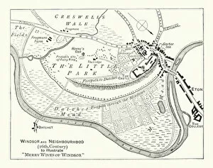
Background imageStreet Plan Collection: Shakespeare: Map illustrating The Merry Wives of Windsor (litho)

Shakespeare: Map illustrating The Merry Wives of Windsor (litho)
7171956 Shakespeare: Map illustrating The Merry Wives of Windsor (litho) by English School, (19th century); Private Collection; (add.info.: Map illustrating The Merry Wives of Windsor)

Background imageStreet Plan Collection: Shakespeare: Map to illustrate Hamlet (litho)

Shakespeare: Map to illustrate Hamlet (litho)
7171866 Shakespeare: Map to illustrate Hamlet (litho) by English School, (19th century); Private Collection; (add.info.: Map to illustrate Hamlet)

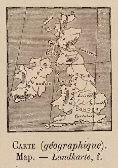
Background imageStreet Plan Collection: Le Vocabulaire Illustre: Carte (geographique); Map; Landkarte (engraving)

Le Vocabulaire Illustre: Carte (geographique); Map; Landkarte (engraving)
7195198 Le Vocabulaire Illustre: Carte (geographique); Map; Landkarte (engraving) by European School, (19th century); Private Collection; (add.info.: Carte (geographique); Map; Landkarte

Background imageStreet Plan Collection: The Source of the Niger (engraving)

The Source of the Niger (engraving)
7164386 The Source of the Niger (engraving) by English School, (19th century); Private Collection; (add.info.: The Source of the Niger)

Background imageStreet Plan Collection: Relative Values and Comparisons, 2 The Worlds Inhabitants (colour litho)

Relative Values and Comparisons, 2 The Worlds Inhabitants (colour litho)
7169528 Relative Values and Comparisons, 2 The Worlds Inhabitants (colour litho) by English School, (20th century); Private Collection; (add.info.: Relative Values and Comparisons)

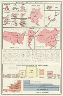
Background imageStreet Plan Collection: Relative Values and Comparisons, 1 Comparative Areas (colour litho)

Relative Values and Comparisons, 1 Comparative Areas (colour litho)
7169526 Relative Values and Comparisons, 1 Comparative Areas (colour litho) by English School, (20th century); Private Collection; (add.info.: Relative Values and Comparisons, 1 Comparative Areas)

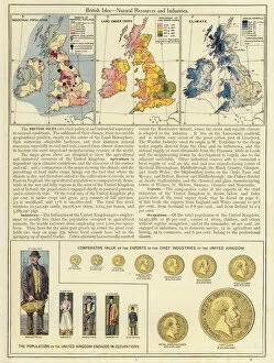
Background imageStreet Plan Collection: British Isles, Natural Resources and Industries (colour litho)

British Isles, Natural Resources and Industries (colour litho)
7169508 British Isles, Natural Resources and Industries (colour litho) by English School, (20th century); Private Collection; (add.info.: British Isles, Natural Resources and Industries)

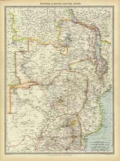
Background imageStreet Plan Collection: Rhodesia and British Central Africa (colour litho)

Rhodesia and British Central Africa (colour litho)
7169504 Rhodesia and British Central Africa (colour litho) by English School, (20th century); Private Collection; (add.info.: Rhodesia and British Central Africa)

Background imageStreet Plan Collection: Africa, Industries and Communications (colour litho)

Africa, Industries and Communications (colour litho)
7169502 Africa, Industries and Communications (colour litho) by English School, (20th century); Private Collection; (add.info.: Africa, Industries and Communications)

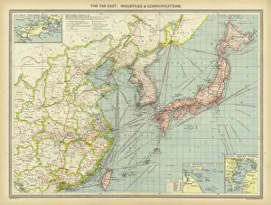
Background imageStreet Plan Collection: The Far East, Industries and Communications (colour litho)

The Far East, Industries and Communications (colour litho)
7169501 The Far East, Industries and Communications (colour litho) by English School, (20th century); Private Collection; (add.info.: The Far East, Industries and Communications)

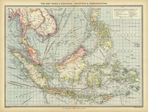
Background imageStreet Plan Collection: The East Indies and Indo-China, Industries and Communications (colour litho)

The East Indies and Indo-China, Industries and Communications (colour litho)
7169500 The East Indies and Indo-China, Industries and Communications (colour litho) by English School, (20th century); Private Collection; (add.info.: The East Indies and Indo-China)

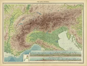
Background imageStreet Plan Collection: The Alps, Physical (colour litho)

The Alps, Physical (colour litho)
7169496 The Alps, Physical (colour litho) by English School, (20th century); Private Collection; (add.info.: The Alps, Physical)

Background imageStreet Plan Collection: Plan of Ely Cathedral and College (woodcut)

Plan of Ely Cathedral and College (woodcut)
7178105 Plan of Ely Cathedral and College (woodcut) by English School, (20th century); Private Collection; (add.info.: Plan of Ely Cathedral and College)

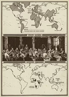
Background imageStreet Plan Collection: Map of the world showing League of Nations members and Mandated Territories (litho)

Map of the world showing League of Nations members and Mandated Territories (litho)
7172856 Map of the world showing League of Nations members and Mandated Territories (litho) by English School, (20th century); Private Collection; (add.info)

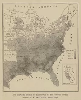
Background imageStreet Plan Collection: Map showing Grades of Illiteracy in the United States, according to the Ninth Census

Map showing Grades of Illiteracy in the United States, according to the Ninth Census, 1870 (engraving)
7170677 Map showing Grades of Illiteracy in the United States, according to the Ninth Census, 1870 (engraving) by American School

Background imageStreet Plan Collection: Map showing the Cotton Region of the United States, according to the Ninth Census, 1870 (engraving)

Map showing the Cotton Region of the United States, according to the Ninth Census, 1870 (engraving)
7170637 Map showing the Cotton Region of the United States, according to the Ninth Census, 1870 (engraving) by American School

Background imageStreet Plan Collection: Pan-American Exposition, 1901, Buffalo, New York, USA (chromolitho)

Pan-American Exposition, 1901, Buffalo, New York, USA (chromolitho)
7153391 Pan-American Exposition, 1901, Buffalo, New York, USA (chromolitho) by American School, (20th century); Private Collection; (add.info.: Pan-American Exposition, 1901, Buffalo, New York)

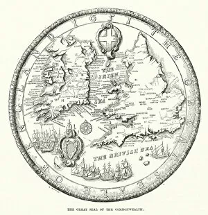
Background imageStreet Plan Collection: The great seal of the Commonwealth (engraving)

The great seal of the Commonwealth (engraving)
7160929 The great seal of the Commonwealth (engraving) by English School, (19th century); Private Collection; (add.info.: The great seal of the Commonwealth)

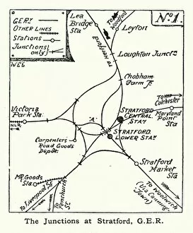
Background imageStreet Plan Collection: Great Eastern Railway junctions at Stratford, London (litho)

Great Eastern Railway junctions at Stratford, London (litho)
7201172 Great Eastern Railway junctions at Stratford, London (litho) by English School, (20th century); Private Collection; (add.info.: Great Eastern Railway junctions at Stratford, London)

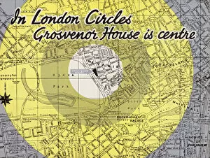
Background imageStreet Plan Collection: Map showing the location if the Grosvenor House Hotel, London (colour litho)

Map showing the location if the Grosvenor House Hotel, London (colour litho)
7202097 Map showing the location if the Grosvenor House Hotel, London (colour litho) by English School, (20th century); Private Collection; (add.info)

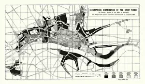
Background imageStreet Plan Collection: Geographical distribution of the Great Plague of London, 1665-1666 (litho)

Geographical distribution of the Great Plague of London, 1665-1666 (litho)
7201755 Geographical distribution of the Great Plague of London, 1665-1666 (litho) by English School, (20th century); Private Collection; (add.info)

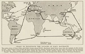
Background imageStreet Plan Collection: Map showing the voyages of the HMS Bacchante (litho)

Map showing the voyages of the HMS Bacchante (litho)
7201700 Map showing the voyages of the HMS Bacchante (litho) by English School, (20th century); Private Collection; (add.info)

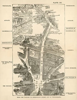
Background imageStreet Plan Collection: London in 1888: From the Poultry to Bishopsgate Street and to Whitechapel (engraving)

London in 1888: From the Poultry to Bishopsgate Street and to Whitechapel (engraving)
7188741 London in 1888: From the Poultry to Bishopsgate Street and to Whitechapel (engraving) by English School, (19th century); Private Collection; (add.info)

Background imageStreet Plan Collection: London in 1888: From Charing Cross to Fleet Street (engraving)

London in 1888: From Charing Cross to Fleet Street (engraving)
7188728 London in 1888: From Charing Cross to Fleet Street (engraving) by English School, (19th century); Private Collection; (add.info.: From Charing Cross to Fleet Street)

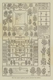
Background imageStreet Plan Collection: Plan d une maison egyptienne, peinture provenant d un tombeau (engraving)

Plan d une maison egyptienne, peinture provenant d un tombeau (engraving)
7179868 Plan d une maison egyptienne, peinture provenant d un tombeau (engraving) by French School, (19th century); Private Collection; (add.info.: Plan d une maison egyptienne)

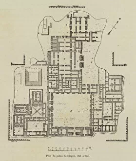
Background imageStreet Plan Collection: Plan du palais de Sargon, etat actuel (engraving)

Plan du palais de Sargon, etat actuel (engraving)
7179857 Plan du palais de Sargon, etat actuel (engraving) by French School, (19th century); Private Collection; (add.info.: Plan du palais de Sargon, etat actuel)

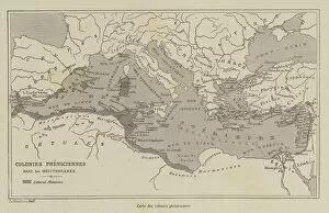
Background imageStreet Plan Collection: Carte des colonies pheniciennes (engraving)

Carte des colonies pheniciennes (engraving)
7179855 Carte des colonies pheniciennes (engraving) by French School, (19th century); Private Collection; (add.info.: Carte des colonies pheniciennes)


For sale as Licensed Images

Choose your image, Select your licence and Download the media

"Exploring the Streets of Old London: A Glimpse into the City's Past" Step back in time with these fascinating street plans that offer a captivating glimpse into the history of London. Delve into the past with an old street map of Bethnal Green and Hackney from 1908, revealing the intricate layout of these vibrant neighborhoods. Travel further east to The Isle of Dogs and discover how it looked in 1908, as you navigate its streets alongside the majestic River Thames at Greenwich. Uncover a hidden gem in Warwickshire with a village plan of Kineton dating back to 1885-1887, showcasing its quaint charm through an unknown creator's artistic vision. Dive beneath the surface as you explore sewer depths in the City of London from 1944, presented vividly through a colorful lithograph that reveals this crucial infrastructure. Journey northwards to Hamstead, Holloway, and Islington using an old street map from 1908; witness how these areas have evolved over time while retaining their unique character. Immerse yourself in grandeur as you traverse The Strand and West End on an exquisite street map from 1908; marvel at its architectural splendor while tracing your steps along the River Thames. Transport yourself to Victorian-era London with engravings depicting iconic routes such as Finsbury Circus to "Angel" Islington via City Road (1888), Euston Road to Paddington via Marylebone Road (1888), and Tottenham Court Road to Camden Town via Hampstead Road (1888). Admire Burlington House on Piccadilly through Johannes Kip's early 18th-century artwork (1908); get lost in its timeless beauty amidst one of London's most prestigious locations.