Street Plan Collection (#4)

"Exploring the Streets of Old London

Background imageStreet Plan Collection: Map of the known world by Herodotus, c450 BC (engraving)

Map of the known world by Herodotus, c450 BC (engraving)
7173433 Map of the known world by Herodotus, c450 BC (engraving) by German School, (19th century); Private Collection; (add.info.: Map of the known world by the Ancient Greek historian Herodotus)

Background imageStreet Plan Collection: Royal Atlas, c 1900: London, Railways (colour litho)

Royal Atlas, c 1900: London, Railways (colour litho)
7198213 Royal Atlas, c 1900: London, Railways (colour litho) by English School, (20th century); Private Collection; (add.info.: London, Railways)

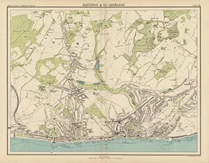
Background imageStreet Plan Collection: Royal Atlas, c 1900: Hastings and St Leonards (colour litho)

Royal Atlas, c 1900: Hastings and St Leonards (colour litho)
7198208 Royal Atlas, c 1900: Hastings and St Leonards (colour litho) by English School, (20th century); Private Collection; (add.info.: Hastings and St Leonards)

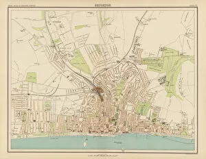
Background imageStreet Plan Collection: Royal Atlas, c 1900: Brighton (colour litho)

Royal Atlas, c 1900: Brighton (colour litho)
7198205 Royal Atlas, c 1900: Brighton (colour litho) by English School, (20th century); Private Collection; (add.info.: Brighton)

Background imageStreet Plan Collection: Royal Atlas, c 1900: Birmingham (colour litho)

Royal Atlas, c 1900: Birmingham (colour litho)
7198202 Royal Atlas, c 1900: Birmingham (colour litho) by English School, (20th century); Private Collection; (add.info.: Birmingham)

Background imageStreet Plan Collection: Royal Atlas, c 1900: Ecclesiastical Divisions (colour litho)

Royal Atlas, c 1900: Ecclesiastical Divisions (colour litho)
7198194 Royal Atlas, c 1900: Ecclesiastical Divisions (colour litho) by English School, (20th century); Private Collection; (add.info.: Ecclesiastical Divisions)

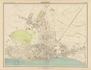
Background imageStreet Plan Collection: Royal Atlas, c 1900: Eastbourne (colour litho)

Royal Atlas, c 1900: Eastbourne (colour litho)
7198207 Royal Atlas, c 1900: Eastbourne (colour litho) by English School, (20th century); Private Collection; (add.info.: Eastbourne)

Background imageStreet Plan Collection: Royal Atlas, c 1900: Blackpool; Sheffield (colour litho)

Royal Atlas, c 1900: Blackpool; Sheffield (colour litho)
7198203 Royal Atlas, c 1900: Blackpool; Sheffield (colour litho) by English School, (20th century); Private Collection; (add.info.: Blackpool; Sheffield)

Background imageStreet Plan Collection: Carte de la domination des Arabes et des Musulmans (engraving)

Carte de la domination des Arabes et des Musulmans (engraving)
7179744 Carte de la domination des Arabes et des Musulmans (engraving) by French School, (19th century); Private Collection; (add.info.: Carte de la domination des Arabes et des Musulmans)

Background imageStreet Plan Collection: Carte de la region parisienne aux premiers ages prehistoriques (engraving)

Carte de la region parisienne aux premiers ages prehistoriques (engraving)
7179740 Carte de la region parisienne aux premiers ages prehistoriques (engraving) by French School, (19th century); Private Collection; (add.info)

Background imageStreet Plan Collection: Map of the walls and seven hills of ancient Rome (litho)

Map of the walls and seven hills of ancient Rome (litho)
7200985 Map of the walls and seven hills of ancient Rome (litho) by English School, (19th century); Private Collection; (add.info.: Map of the walls and seven hills of Rome during the Roman Empire)

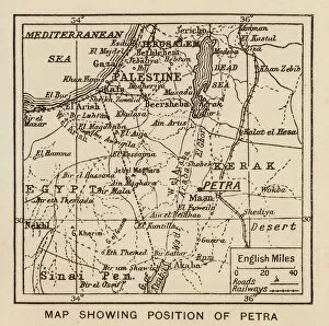
Background imageStreet Plan Collection: Map showing position of Petra (litho)

Map showing position of Petra (litho)
7199405 Map showing position of Petra (litho) by English School, (20th century); Private Collection; (add.info.: Map showing position of Petra)

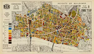
Background imageStreet Plan Collection: Heights of buildings in the City of London, 1936 (colour litho)

Heights of buildings in the City of London, 1936 (colour litho)
7201426 Heights of buildings in the City of London, 1936 (colour litho) by English School, (20th century); Private Collection; (add.info)

Background imageStreet Plan Collection: Italy, showing roads and regions during the Roman Empire (litho)

Italy, showing roads and regions during the Roman Empire (litho)
7200991 Italy, showing roads and regions during the Roman Empire (litho) by English School, (19th century); Private Collection; (add.info.: Italy, showing roads and regions during the Roman Empire)

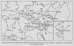
Background imageStreet Plan Collection: Map showing the relay of the broadcast of the Franz Schubert Centenary Celebrations from Vienna

Map showing the relay of the broadcast of the Franz Schubert Centenary Celebrations from Vienna (litho)
7200337 Map showing the relay of the broadcast of the Franz Schubert Centenary Celebrations from Vienna (litho) by English School

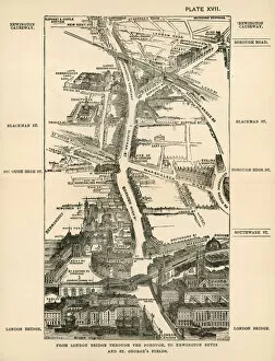
Background imageStreet Plan Collection: London in 1888: From London Bridge through the Borough, to Newington Butts and St Georges Fields

London in 1888: From London Bridge through the Borough, to Newington Butts and St Georges Fields (engraving)
7188746 London in 1888: From London Bridge through the Borough, to Newington Butts and St Georges Fields (engraving) by English School

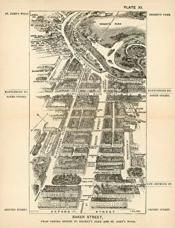
Background imageStreet Plan Collection: London in 1888: Baker Street, from Oxford Street to Regents Park and St Johns Wood (engraving)

London in 1888: Baker Street, from Oxford Street to Regents Park and St Johns Wood (engraving)
7188737 London in 1888: Baker Street, from Oxford Street to Regents Park and St Johns Wood (engraving) by English School, (19th century); Private Collection; (add.info.: Baker Street)

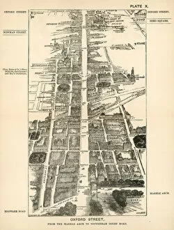
Background imageStreet Plan Collection: London in 1888: Oxford Street, from the Marble Arch to Tottenham Court Road (engraving)

London in 1888: Oxford Street, from the Marble Arch to Tottenham Court Road (engraving)
7188736 London in 1888: Oxford Street, from the Marble Arch to Tottenham Court Road (engraving) by English School, (19th century); Private Collection; (add.info.: Oxford Street)

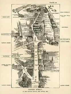
Background imageStreet Plan Collection: London in 1888: Canon Street, to the Mansion House, the Tower, etc (engraving)

London in 1888: Canon Street, to the Mansion House, the Tower, etc (engraving)
7188731 London in 1888: Canon Street, to the Mansion House, the Tower, etc (engraving) by English School, (19th century); Private Collection; (add.info.: Canon Street, to the Mansion House)

Background imageStreet Plan Collection: Plan of the Roman Fora (engraving)

Plan of the Roman Fora (engraving)
7193921 Plan of the Roman Fora (engraving) by European School, (19th century); Private Collection; (add.info.: Plan of the Roman Fora)

Background imageStreet Plan Collection: Sixteenth Century plan of the beacons of Kent (litho)

Sixteenth Century plan of the beacons of Kent (litho)
7186556 Sixteenth Century plan of the beacons of Kent (litho) by English School, (20th century); Private Collection; (add.info.: Sixteenth Century plan of the beacons of Kent)

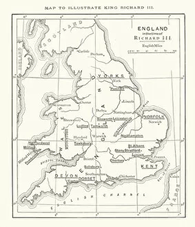
Background imageStreet Plan Collection: Shakespeare: Map to illustrate King Richard III (litho)

Shakespeare: Map to illustrate King Richard III (litho)
7171927 Shakespeare: Map to illustrate King Richard III (litho) by English School, (19th century); Private Collection; (add.info.: Map to illustrate King Richard III)

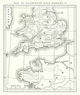
Background imageStreet Plan Collection: Shakespeare: Map to illustrate King Richard II (litho)

Shakespeare: Map to illustrate King Richard II (litho)
7171785 Shakespeare: Map to illustrate King Richard II (litho) by English School, (19th century); Private Collection; (add.info.: Map to illustrate King Richard II)

Background imageStreet Plan Collection: Shakespeare: Map to illustrate Macbeth (litho)

Shakespeare: Map to illustrate Macbeth (litho)
7172012 Shakespeare: Map to illustrate Macbeth (litho) by English School, (19th century); Private Collection; (add.info.: Map to illustrate Macbeth)

Background imageStreet Plan Collection: Shakespeare: Map to illustrate Troilus and Cressida (litho)

Shakespeare: Map to illustrate Troilus and Cressida (litho)
7172003 Shakespeare: Map to illustrate Troilus and Cressida (litho) by English School, (19th century); Private Collection; (add.info.: Map to illustrate Troilus and Cressida)

Background imageStreet Plan Collection: Shakespeare: Map to illustrate King John (litho)

Shakespeare: Map to illustrate King John (litho)
7171930 Shakespeare: Map to illustrate King John (litho) by English School, (19th century); Private Collection; (add.info.: Map to illustrate King John)

Background imageStreet Plan Collection: Shakespeare: Map to illustrate King Henry VI, Part 2 (litho)

Shakespeare: Map to illustrate King Henry VI, Part 2 (litho)
7171762 Shakespeare: Map to illustrate King Henry VI, Part 2 (litho) by English School, (19th century); Private Collection; (add.info.: Map to illustrate King Henry VI, Part 2)

Background imageStreet Plan Collection: Shakespeare: Map to illustrate Loves Labours Lost (litho)

Shakespeare: Map to illustrate Loves Labours Lost (litho)
7171727 Shakespeare: Map to illustrate Loves Labours Lost (litho) by English School, (19th century); Private Collection; (add.info.: Map to illustrate Loves Labours Lost)

Background imageStreet Plan Collection: London in 1888: New Oxford Street and Holborn, to Smithfield and Cheapside (engraving)

London in 1888: New Oxford Street and Holborn, to Smithfield and Cheapside (engraving)
7188739 London in 1888: New Oxford Street and Holborn, to Smithfield and Cheapside (engraving) by English School, (19th century); Private Collection; (add.info.: New Oxford Street and Holborn)

Background imageStreet Plan Collection: London in 1888: Edgware Road, from Marble Arch to Westbourne Grove (engraving)

London in 1888: Edgware Road, from Marble Arch to Westbourne Grove (engraving)
7188734 London in 1888: Edgware Road, from Marble Arch to Westbourne Grove (engraving) by English School, (19th century); Private Collection; (add.info.: Edgware Road)

Background imageStreet Plan Collection: London in 1888: Fleet Street and Ludgate Hill to St Pauls and Cheapside, etc (engraving)

London in 1888: Fleet Street and Ludgate Hill to St Pauls and Cheapside, etc (engraving)
7188730 London in 1888: Fleet Street and Ludgate Hill to St Pauls and Cheapside, etc (engraving) by English School, (19th century); Private Collection; (add.info)

Background imageStreet Plan Collection: The Wilderness Journey (engraving)

The Wilderness Journey (engraving)
7182515 The Wilderness Journey (engraving) by English School, (19th century); Private Collection; (add.info.: The Wilderness Journey)

Background imageStreet Plan Collection: Plan of the Principal Floor of Hampton Court Palace in the time of the Stuarts (engraving)

Plan of the Principal Floor of Hampton Court Palace in the time of the Stuarts (engraving)
7179066 Plan of the Principal Floor of Hampton Court Palace in the time of the Stuarts (engraving) by English School, (19th century); Private Collection; (add.info)

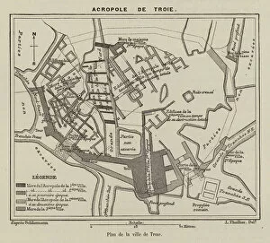
Background imageStreet Plan Collection: Plan de la ville de Troie (engraving)

Plan de la ville de Troie (engraving)
7179851 Plan de la ville de Troie (engraving) by French School, (19th century); Private Collection; (add.info.: Plan de la ville de Troie)

Background imageStreet Plan Collection: Plan de la maison de Livie, Epoque imperiale (engraving)

Plan de la maison de Livie, Epoque imperiale (engraving)
7179814 Plan de la maison de Livie, Epoque imperiale (engraving) by French School, (19th century); Private Collection; (add.info.: Plan de la maison de Livie, Epoque imperiale)

Background imageStreet Plan Collection: Plan d un hotel du XVIIIe siecle (engraving)

Plan d un hotel du XVIIIe siecle (engraving)
7179774 Plan d un hotel du XVIIIe siecle (engraving) by French School, (19th century); Private Collection; (add.info.: Plan d un hotel du XVIIIe siecle)

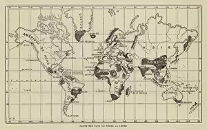
Background imageStreet Plan Collection: Carte des Pays ou Regne la Lepre (engraving)

Carte des Pays ou Regne la Lepre (engraving)
7158234 Carte des Pays ou Regne la Lepre (engraving) by French School, (19th century); Private Collection; (add.info.: Carte des Pays ou Regne la Lepre)

Background imageStreet Plan Collection: France Climatologique (engraving)

France Climatologique (engraving)
7158182 France Climatologique (engraving) by French School, (19th century); Private Collection; (add.info.: France Climatologique)

Background imageStreet Plan Collection: France, Carte des Pluies (engraving)

France, Carte des Pluies (engraving)
7158180 France, Carte des Pluies (engraving) by French School, (19th century); Private Collection; (add.info.: France, Carte des Pluies)

Background imageStreet Plan Collection: Principaux Chemins de Fer et Voies Navigables (engraving)

Principaux Chemins de Fer et Voies Navigables (engraving)
7158177 Principaux Chemins de Fer et Voies Navigables (engraving) by French School, (19th century); Private Collection; (add.info.: Principaux Chemins de Fer et Voies Navigables)

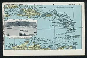
Background imageStreet Plan Collection: The town and harbour of St Thomas, Dutch West Indies with a map of the Caribbean (engraving)

The town and harbour of St Thomas, Dutch West Indies with a map of the Caribbean (engraving)
7153604 The town and harbour of St Thomas, Dutch West Indies with a map of the Caribbean (engraving) by English School, (20th century); Private Collection; (add.info)

Background imageStreet Plan Collection: Carte des Courants (engraving)

Carte des Courants (engraving)
7158313 Carte des Courants (engraving) by French School, (19th century); Private Collection; (add.info.: Carte des Courants)

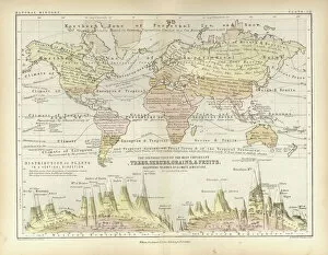
Background imageStreet Plan Collection: Trees, Shrubs, Grains, and Fruits (coloured engraving)

Trees, Shrubs, Grains, and Fruits (coloured engraving)
7159922 Trees, Shrubs, Grains, and Fruits (coloured engraving) by English School, (19th century); Private Collection; (add.info.: Trees, Shrubs, Grains, and Fruits)

Background imageStreet Plan Collection: Winds over the Globe (coloured engraving)

Winds over the Globe (coloured engraving)
7159920 Winds over the Globe (coloured engraving) by English School, (19th century); Private Collection; (add.info.: Winds over the Globe)

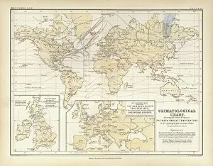
Background imageStreet Plan Collection: Climatological Chart (coloured engraving)

Climatological Chart (coloured engraving)
7159918 Climatological Chart (coloured engraving) by English School, (19th century); Private Collection; (add.info.: Climatological Chart)

Background imageStreet Plan Collection: Asia (coloured engraving)

Asia (coloured engraving)
7159913 Asia (coloured engraving) by English School, (19th century); Private Collection; (add.info.: Asia. Illustration for A School Atlas of Physical Geography by Alex Keith Johnston)

Background imageStreet Plan Collection: The Inland Seas and Lakes of the Globe (coloured engraving)

The Inland Seas and Lakes of the Globe (coloured engraving)
7159910 The Inland Seas and Lakes of the Globe (coloured engraving) by English School, (19th century); Private Collection; (add.info.: The Inland Seas and Lakes of the Globe)

Background imageStreet Plan Collection: The campylometer (engraving)

The campylometer (engraving)
7163252 The campylometer (engraving) by European School, (19th century); Private Collection; (add.info.: The campylometer)


For sale as Licensed Images

Choose your image, Select your licence and Download the media

"Exploring the Streets of Old London: A Glimpse into the City's Past" Step back in time with these fascinating street plans that offer a captivating glimpse into the history of London. Delve into the past with an old street map of Bethnal Green and Hackney from 1908, revealing the intricate layout of these vibrant neighborhoods. Travel further east to The Isle of Dogs and discover how it looked in 1908, as you navigate its streets alongside the majestic River Thames at Greenwich. Uncover a hidden gem in Warwickshire with a village plan of Kineton dating back to 1885-1887, showcasing its quaint charm through an unknown creator's artistic vision. Dive beneath the surface as you explore sewer depths in the City of London from 1944, presented vividly through a colorful lithograph that reveals this crucial infrastructure. Journey northwards to Hamstead, Holloway, and Islington using an old street map from 1908; witness how these areas have evolved over time while retaining their unique character. Immerse yourself in grandeur as you traverse The Strand and West End on an exquisite street map from 1908; marvel at its architectural splendor while tracing your steps along the River Thames. Transport yourself to Victorian-era London with engravings depicting iconic routes such as Finsbury Circus to "Angel" Islington via City Road (1888), Euston Road to Paddington via Marylebone Road (1888), and Tottenham Court Road to Camden Town via Hampstead Road (1888). Admire Burlington House on Piccadilly through Johannes Kip's early 18th-century artwork (1908); get lost in its timeless beauty amidst one of London's most prestigious locations.