Street Plan Collection (#6)

"Exploring the Streets of Old London

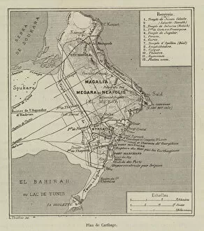
Background imageStreet Plan Collection: Plan de Carthage (engraving)

Plan de Carthage (engraving)
7179854 Plan de Carthage (engraving) by French School, (19th century); Private Collection; (add.info.: Plan de Carthage. Illustration for L Habitation Humaine by Charles Garnier and A Ammann)

Background imageStreet Plan Collection: Carte de l Etrurie (engraving)

Carte de l Etrurie (engraving)
7179848 Carte de l Etrurie (engraving) by French School, (19th century); Private Collection; (add.info.: Carte de l Etrurie)

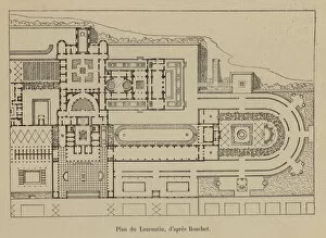
Background imageStreet Plan Collection: Plan du Laurentin (engraving)

Plan du Laurentin (engraving)
7179806 Plan du Laurentin (engraving) by French School, (19th century); Private Collection; (add.info.: Plan du Laurentin)

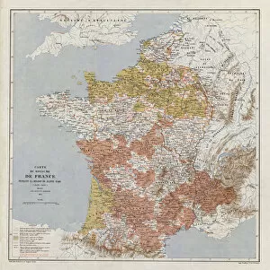
Background imageStreet Plan Collection: Map of France at the time of Joan of Arc, 1429-1430 (coloured engraving)

Map of France at the time of Joan of Arc, 1429-1430 (coloured engraving)
7185148 Map of France at the time of Joan of Arc, 1429-1430 (coloured engraving) by French School, (19th century); Private Collection; (add.info.: Map of France at the time of Joan of Arc, 1429-1430)

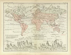
Background imageStreet Plan Collection: Animals (coloured engraving)

Animals (coloured engraving)
7159923 Animals (coloured engraving) by English School, (19th century); Private Collection; (add.info.: Animals. Illustration for A School Atlas of Physical Geography by Alex Keith Johnston)
Background imageStreet Plan Collection: Rain and Snow (coloured engraving)

Rain and Snow (coloured engraving)
7159921 Rain and Snow (coloured engraving) by English School, (19th century); Private Collection; (add.info.: Rain and Snow)

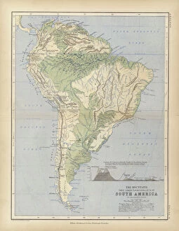
Background imageStreet Plan Collection: South America (coloured engraving)

South America (coloured engraving)
7159916 South America (coloured engraving) by English School, (19th century); Private Collection; (add.info.: South America)

Background imageStreet Plan Collection: The River Systems (coloured engraving)

The River Systems (coloured engraving)
7159911 The River Systems (coloured engraving) by English School, (19th century); Private Collection; (add.info.: The River Systems)

Background imageStreet Plan Collection: Peuples de la Gaule (engraving)

Peuples de la Gaule (engraving)
7158291 Peuples de la Gaule (engraving) by French School, (19th century); Private Collection; (add.info.: Peuples de la Gaule)

Background imageStreet Plan Collection: France Geologique (engraving)

France Geologique (engraving)
7158187 France Geologique (engraving) by French School, (19th century); Private Collection; (add.info.: France Geologique)

Background imageStreet Plan Collection: Royal Atlas, c 1900: Nottingham (colour litho)

Royal Atlas, c 1900: Nottingham (colour litho)
7198215 Royal Atlas, c 1900: Nottingham (colour litho) by English School, (20th century); Private Collection; (add.info.: Nottingham)

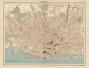
Background imageStreet Plan Collection: Royal Atlas, c 1900: Liverpool (colour litho)

Royal Atlas, c 1900: Liverpool (colour litho)
7198209 Royal Atlas, c 1900: Liverpool (colour litho) by English School, (20th century); Private Collection; (add.info.: Liverpool)

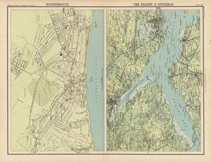
Background imageStreet Plan Collection: Royal Atlas, c 1900: Bournemouth; The Solent and Spithead (colour litho)

Royal Atlas, c 1900: Bournemouth; The Solent and Spithead (colour litho)
7198204 Royal Atlas, c 1900: Bournemouth; The Solent and Spithead (colour litho) by English School, (20th century); Private Collection; (add.info.: Bournemouth; The Solent and Spithead)

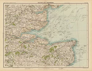
Background imageStreet Plan Collection: Royal Atlas, c 1900: Canterbury (colour litho)

Royal Atlas, c 1900: Canterbury (colour litho)
7198201 Royal Atlas, c 1900: Canterbury (colour litho) by English School, (20th century); Private Collection; (add.info.: Canterbury)

Background imageStreet Plan Collection: London in 1888: From Charing Cross through Whitehall to Westminster (engraving)

London in 1888: From Charing Cross through Whitehall to Westminster (engraving)
7188729 London in 1888: From Charing Cross through Whitehall to Westminster (engraving) by English School, (19th century); Private Collection; (add.info)

Background imageStreet Plan Collection: Shakespeare: Map to illustrate The Winters Tale (litho)

Shakespeare: Map to illustrate The Winters Tale (litho)
7171838 Shakespeare: Map to illustrate The Winters Tale (litho) by English School, (19th century); Private Collection; (add.info.: Map to illustrate The Winters Tale)

Background imageStreet Plan Collection: Shakespeare: Map to illustrate Henry VIII (litho)

Shakespeare: Map to illustrate Henry VIII (litho)
7171869 Shakespeare: Map to illustrate Henry VIII (litho) by English School, (19th century); Private Collection; (add.info.: Map to illustrate Henry VIII)

Background imageStreet Plan Collection: Shakespeare: Map to illustrated Titus Andronicus (litho)

Shakespeare: Map to illustrated Titus Andronicus (litho)
7171822 Shakespeare: Map to illustrated Titus Andronicus (litho) by English School, (19th century); Private Collection; (add.info.: Map to illustrated Titus Andronicus)

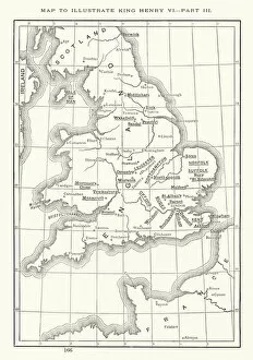
Background imageStreet Plan Collection: Shakespeare: Map to illustrate King Henry VI, Part 3 (litho)

Shakespeare: Map to illustrate King Henry VI, Part 3 (litho)
7171767 Shakespeare: Map to illustrate King Henry VI, Part 3 (litho) by English School, (19th century); Private Collection; (add.info.: Map to illustrate King Henry VI, Part 3)

Background imageStreet Plan Collection: Shakespeare: Map to illustrate Julius Caesar (litho)

Shakespeare: Map to illustrate Julius Caesar (litho)
7171975 Shakespeare: Map to illustrate Julius Caesar (litho) by English School, (19th century); Private Collection; (add.info.: Map to illustrate Julius Caesar)

Background imageStreet Plan Collection: Shakespeare: Map to illustrate King Lear (litho)

Shakespeare: Map to illustrate King Lear (litho)
7171916 Shakespeare: Map to illustrate King Lear (litho) by English School, (19th century); Private Collection; (add.info.: Map to illustrate King Lear)

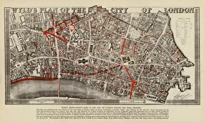
Background imageStreet Plan Collection: Wylds plan of the City of London (colour litho)

Wylds plan of the City of London (colour litho)
7201428 Wylds plan of the City of London (colour litho) by English School, (20th century); Private Collection; (add.info)

Background imageStreet Plan Collection: Height of buildings zoning, City of London (colour litho)

Height of buildings zoning, City of London (colour litho)
7201422 Height of buildings zoning, City of London (colour litho) by English School, (20th century); Private Collection; (add.info.: Height of buildings zoning, City of London. drawing number 2)
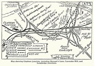
Background imageStreet Plan Collection: Railway map showing Clapham Junction, including Stewarts Lane

Railway map showing Clapham Junction, including Stewarts Lane, Lavender Hill and Longhedge junctions, London (litho)
7201174 Railway map showing Clapham Junction, including Stewarts Lane, Lavender Hill and Longhedge junctions, London (litho) by English School

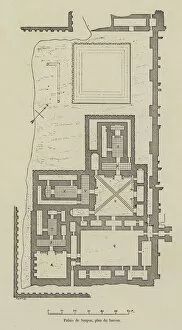
Background imageStreet Plan Collection: Palais de Sargon, plan du harem (engraving)

Palais de Sargon, plan du harem (engraving)
7179856 Palais de Sargon, plan du harem (engraving) by French School, (19th century); Private Collection; (add.info.: Palais de Sargon, plan du harem)

Background imageStreet Plan Collection: Distribution des races humaines a la surface de la terre (engraving)

Distribution des races humaines a la surface de la terre (engraving)
7179747 Distribution des races humaines a la surface de la terre (engraving) by French School, (19th century); Private Collection; (add.info)

Background imageStreet Plan Collection: Carte de l invasion des Barbares (engraving)

Carte de l invasion des Barbares (engraving)
7179745 Carte de l invasion des Barbares (engraving) by French School, (19th century); Private Collection; (add.info.: Carte de l invasion des Barbares)

Background imageStreet Plan Collection: London in 1888: The Thames, from the Tower to Westminster (engraving)

London in 1888: The Thames, from the Tower to Westminster (engraving)
7188747 London in 1888: The Thames, from the Tower to Westminster (engraving) by English School, (19th century); Private Collection; (add.info.: The Thames, from the Tower to Westminster)

Background imageStreet Plan Collection: Royal Atlas, c 1900: Durham; York (colour litho)

Royal Atlas, c 1900: Durham; York (colour litho)
7198219 Royal Atlas, c 1900: Durham; York (colour litho) by English School, (20th century); Private Collection; (add.info.: Durham; York)

Background imageStreet Plan Collection: Royal Atlas, c 1900: Buxton; Warwick; Cheltenham (colour litho)

Royal Atlas, c 1900: Buxton; Warwick; Cheltenham (colour litho)
7198206 Royal Atlas, c 1900: Buxton; Warwick; Cheltenham (colour litho) by English School, (20th century); Private Collection; (add.info.: Buxton; Warwick; Cheltenham)

Background imageStreet Plan Collection: Royal Atlas, c 1900: Manchester and Salford (colour litho)

Royal Atlas, c 1900: Manchester and Salford (colour litho)
7198212 Royal Atlas, c 1900: Manchester and Salford (colour litho) by English School, (20th century); Private Collection; (add.info.: Manchester and Salford)

Background imageStreet Plan Collection: Royal Atlas, c 1900: Land Surface Features (colour litho)

Royal Atlas, c 1900: Land Surface Features (colour litho)
7198198 Royal Atlas, c 1900: Land Surface Features (colour litho) by English School, (20th century); Private Collection; (add.info.: Land Surface Features)

Background imageStreet Plan Collection: Journal of Prince Maximilian of Wied, 1832-34 (ink and w / c on paper)

Journal of Prince Maximilian of Wied, 1832-34 (ink and w / c on paper)
5054761 Journal of Prince Maximilian of Wied, 1832-34 (ink and w/c on paper) by German School, (19th century); Joslyn Museum, Omaha, Nebraska

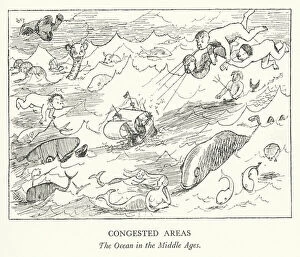
Background imageStreet Plan Collection: Congested Areas, The Ocean in the Middle Ages (litho)

Congested Areas, The Ocean in the Middle Ages (litho)
7168512 Congested Areas, The Ocean in the Middle Ages (litho) by Pont (Graham Laidler) (1908-40); Private Collection; (add.info.: Congested Areas, The Ocean in the Middle Ages)

Background imageStreet Plan Collection: Relative Values and Comparisons, 5 The Merchant Shipping of the World (colour litho)

Relative Values and Comparisons, 5 The Merchant Shipping of the World (colour litho)
7169532 Relative Values and Comparisons, 5 The Merchant Shipping of the World (colour litho) by English School, (20th century); Private Collection; (add.info.: Relative Values and Comparisons)

Background imageStreet Plan Collection: The Worlds Commodities, 16 Steel, Lead and Tin (colour litho)

The Worlds Commodities, 16 Steel, Lead and Tin (colour litho)
7169527 The Worlds Commodities, 16 Steel, Lead and Tin (colour litho) by English School, (20th century); Private Collection; (add.info.: The Worlds Commodities, 16 Steel, Lead and Tin)

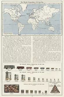
Background imageStreet Plan Collection: The Worlds Commodities, 15 Iron Ore (colour litho)

The Worlds Commodities, 15 Iron Ore (colour litho)
7169525 The Worlds Commodities, 15 Iron Ore (colour litho) by English School, (20th century); Private Collection; (add.info.: The Worlds Commodities, 15 Iron Ore)

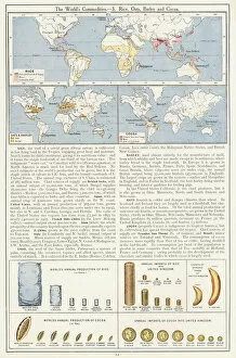
Background imageStreet Plan Collection: The Worlds Commodities, 3 Rice, Oats, Barley and Cocoa (colour litho)

The Worlds Commodities, 3 Rice, Oats, Barley and Cocoa (colour litho)
7169513 The Worlds Commodities, 3 Rice, Oats, Barley and Cocoa (colour litho) by English School, (20th century); Private Collection; (add.info.: The Worlds Commodities, 3 Rice, Oats)

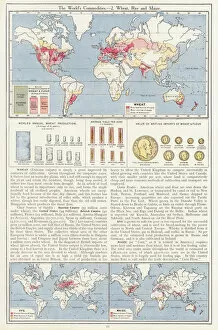
Background imageStreet Plan Collection: The Worlds Commodities, 2 Wheat, Rye and Maize (colour litho)

The Worlds Commodities, 2 Wheat, Rye and Maize (colour litho)
7169512 The Worlds Commodities, 2 Wheat, Rye and Maize (colour litho) by English School, (20th century); Private Collection; (add.info.: The Worlds Commodities, 2 Wheat, Rye and Maize)

Background imageStreet Plan Collection: Ireland, Railway Systems (colour litho)

Ireland, Railway Systems (colour litho)
7169497 Ireland, Railway Systems (colour litho) by English School, (20th century); Private Collection; (add.info.: Ireland, Railway Systems)

Background imageStreet Plan Collection: Atlantic Ocean, Cables and Ocean Depths (colour litho)

Atlantic Ocean, Cables and Ocean Depths (colour litho)
7169493 Atlantic Ocean, Cables and Ocean Depths (colour litho) by English School, (20th century); Private Collection; (add.info.: Atlantic Ocean, Cables and Ocean Depths)

Background imageStreet Plan Collection: The British Isles, Physical (colour litho)

The British Isles, Physical (colour litho)
7169492 The British Isles, Physical (colour litho) by English School, (20th century); Private Collection; (add.info.: The British Isles, Physical)

Background imageStreet Plan Collection: Religious Belief (coloured engraving)

Religious Belief (coloured engraving)
7159930 Religious Belief (coloured engraving) by English School, (19th century); Private Collection; (add.info.: Religious Belief)

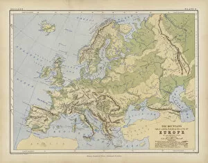
Background imageStreet Plan Collection: Europe (coloured engraving)

Europe (coloured engraving)
7159912 Europe (coloured engraving) by English School, (19th century); Private Collection; (add.info.: Europe. Illustration for A School Atlas of Physical Geography by Alex Keith Johnston)

Background imageStreet Plan Collection: Illustrations of Chartography (coloured engraving)

Illustrations of Chartography (coloured engraving)
7159908 Illustrations of Chartography (coloured engraving) by English School, (19th century); Private Collection; (add.info.: Illustrations of Chartography)

Background imageStreet Plan Collection: Zoological Gardens, Ghent, Belgium (colour litho)

Zoological Gardens, Ghent, Belgium (colour litho)
7154172 Zoological Gardens, Ghent, Belgium (colour litho) by European School, (19th century); Private Collection; (add.info.: Zoological Gardens, Ghent, Belgium)

Background imageStreet Plan Collection: Cabanas, cigar label (chromolitho)

Cabanas, cigar label (chromolitho)
7154110 Cabanas, cigar label (chromolitho) by American School, (19th century); Private Collection; (add.info.: Cabanas, cigar label)

Background imageStreet Plan Collection: Correct Survey of Dublin, As It Stood in the Year 1610, published July 1792

Correct Survey of Dublin, As It Stood in the Year 1610, published July 1792


For sale as Licensed Images

Choose your image, Select your licence and Download the media

"Exploring the Streets of Old London: A Glimpse into the City's Past" Step back in time with these fascinating street plans that offer a captivating glimpse into the history of London. Delve into the past with an old street map of Bethnal Green and Hackney from 1908, revealing the intricate layout of these vibrant neighborhoods. Travel further east to The Isle of Dogs and discover how it looked in 1908, as you navigate its streets alongside the majestic River Thames at Greenwich. Uncover a hidden gem in Warwickshire with a village plan of Kineton dating back to 1885-1887, showcasing its quaint charm through an unknown creator's artistic vision. Dive beneath the surface as you explore sewer depths in the City of London from 1944, presented vividly through a colorful lithograph that reveals this crucial infrastructure. Journey northwards to Hamstead, Holloway, and Islington using an old street map from 1908; witness how these areas have evolved over time while retaining their unique character. Immerse yourself in grandeur as you traverse The Strand and West End on an exquisite street map from 1908; marvel at its architectural splendor while tracing your steps along the River Thames. Transport yourself to Victorian-era London with engravings depicting iconic routes such as Finsbury Circus to "Angel" Islington via City Road (1888), Euston Road to Paddington via Marylebone Road (1888), and Tottenham Court Road to Camden Town via Hampstead Road (1888). Admire Burlington House on Piccadilly through Johannes Kip's early 18th-century artwork (1908); get lost in its timeless beauty amidst one of London's most prestigious locations.