
Netherlands Collection
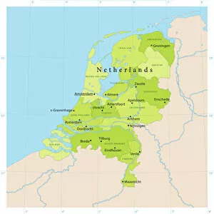
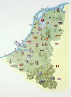
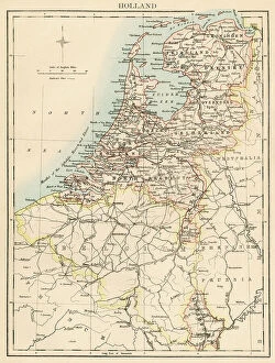
Netherlands is a country located in Western Europe, bordered by Germany to the east and Belgium to the south
Choose a picture from our Netherlands Collection for your Wall Art and Photo Gifts
549 items
All Professionally Made to Order for Quick Shipping
-
Netherlands Collection
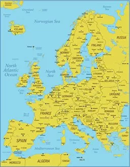
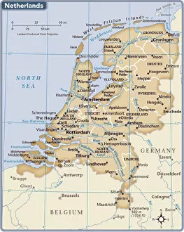
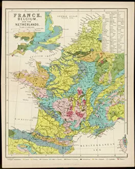
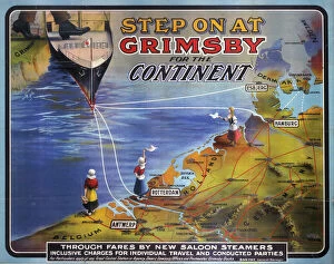
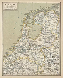
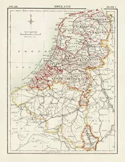
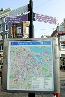
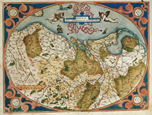
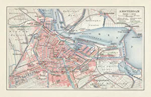
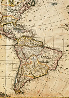
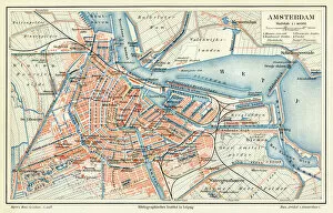
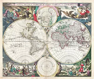
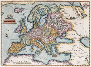
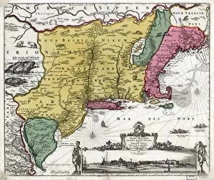
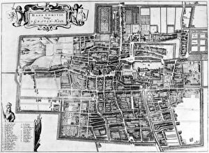
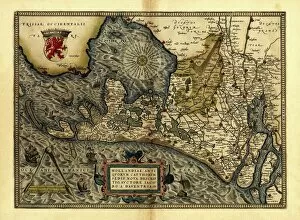
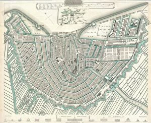
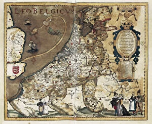
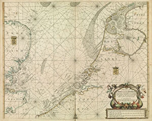
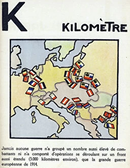
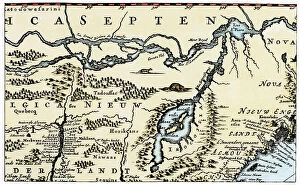
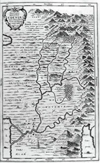
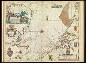
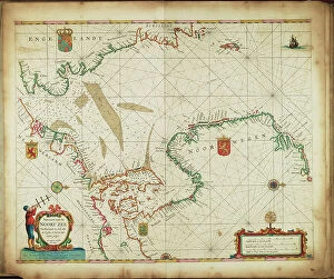
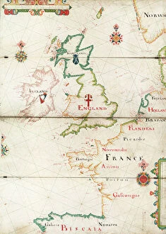
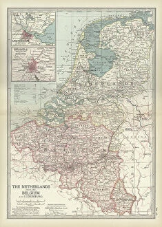
Netherlands is a country located in Western Europe, bordered by Germany to the east and Belgium to the south. The country has a population of approximately 17 million people and covers an area of 41,543 square kilometers. Amsterdam is its capital city, while Rotterdam is the largest port in Europe. Netherlands boasts of a highly developed economy with agriculture being one of its main industries. The country's topography comprises low-lying flatlands that are prone to flooding; hence it has invested heavily in water management infrastructure such as dikes and dams. Maps and charts provide detailed information about the geography, demographics, transportation networks, land use patterns among other aspects of this beautiful nation.
+
Our beautiful Wall Art and Photo Gifts include Framed Prints, Photo Prints, Poster Prints, Canvas Prints, Jigsaw Puzzles, Metal Prints and so much more
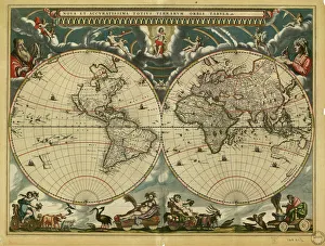
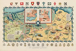
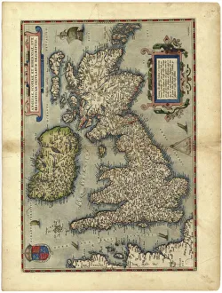
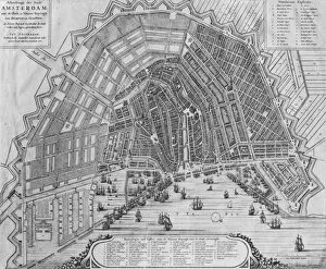
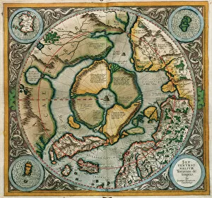
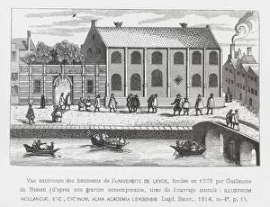
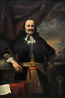
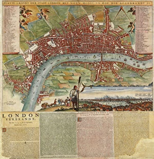
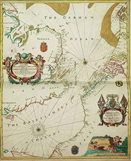
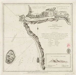
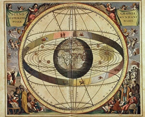
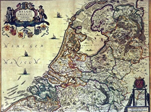
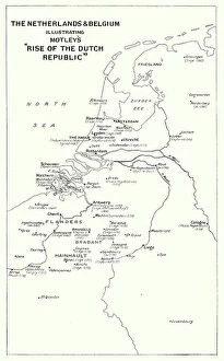
The Netherlands collection from Media Storehouse offers a wide range of wall art and framed prints that depict the geography, history, and culture of this European country. Our collection features vintage maps, charts, and illustrations that showcase the intricate canal system, windmills, tulip fields, iconic landmarks such as the Rijksmuseum and Anne Frank House in Amsterdam. These artworks also provide an insight into Dutch maritime history with depictions of famous ships like VOC or East India Company vessels. Our collection is curated to cater to diverse tastes with various styles ranging from antique engravings to modern digital designs. The high-quality prints are available in different sizes making them suitable for any room decor. Whether you're looking for a unique gift or want to add some character to your home or office space, the Netherlands collection has something for everyone who appreciates Dutch heritage.
+
What are Netherlands (Maps and Charts) art prints?
Netherlands art prints are a collection of high-quality, visually stunning images that showcase the geography and history of the Netherlands. These prints feature detailed maps and charts that highlight various regions, cities, rivers, canals, and landmarks throughout the country. The artwork is created using advanced printing techniques to ensure vibrant colors and crisp details. These art prints are perfect for anyone who loves Dutch culture or wants to learn more about the country's rich history. They make great additions to any home or office decor, adding a touch of sophistication and elegance to any space. Whether you're looking for a unique gift idea or want to decorate your own walls with beautiful artwork, these Netherlands art prints are sure to impress. We offer a wide variety of sizes and framing options so you can customize your print exactly how you want it. With fast shipping times and excellent customer service, ordering from Media Storehouse is easy and hassle-free.
+
What Netherlands (Maps and Charts) art prints can I buy from Media Storehouse?
We offer a wide range of Netherlands art prints in the form of maps and charts. These prints showcase the beauty and history of this European country, with stunning depictions of its cities, landmarks, and landscapes. Some popular options include antique maps that show the layout and geography of different regions within the Netherlands, as well as vintage charts that highlight important historical events or cultural traditions. In addition to traditional paper prints, Media Storehouse also offers canvas prints that can be stretched over a frame for easy display on your wall. These high-quality reproductions are perfect for adding a touch of Dutch charm to any room in your home or office. Whether you're looking for a unique gift or simply want to decorate your own space with beautiful artwork inspired by the Netherlands, we have something for everyone. With our extensive collection of maps and charts from this fascinating country, you're sure to find just what you're looking for.
+
How do I buy Netherlands (Maps and Charts) art prints?
To buy Netherlands art prints from Media Storehouse, you can browse through our extensive collection of artwork online. Once you have found the print that you like, simply add it to your cart and proceed to checkout. You will be prompted to enter your shipping and payment information before finalizing your purchase. We offer a variety of sizes for their prints, so make sure to select the size that best fits your needs. We also offer different framing options if you prefer a framed print. If you have any questions or concerns about purchasing Netherlands art prints from Media Storehouse, they have a customer service team available to assist you. Simply reach out to them via email or phone for help with your order. Buying Netherlands art prints from Media Storehouse is easy and convenient thanks to their user-friendly website and helpful customer service team.
+
How much do Netherlands (Maps and Charts) art prints cost?
We offer a wide range of Netherlands art prints at varying prices. Our collection includes high-quality reproductions of vintage maps and charts depicting the geography, topography, and history of the Netherlands. The cost of each print depends on several factors such as its size, quality, and rarity. We have options for every budget ranging from affordable posters to premium giclee prints that are perfect for collectors or those who want museum-quality artwork in their homes or offices. Our prints are available in different sizes to suit your needs and preferences. Whether you're looking for a unique gift or want to add some character to your space, our Netherlands art prints are an excellent choice. With our extensive selection of designs at various price points, you're sure to find something that fits your style and budget.
+
How will my Netherlands (Maps and Charts) art prints be delivered to me?
Your Netherlands art prints will be delivered to you in a safe and secure manner. We take great care in ensuring that your artwork arrives at your doorstep in pristine condition. We use high-quality packaging materials to protect your prints during transit. Your order will be shipped using reliable shipping carriers who have a proven track record of delivering packages on time. You can rest assured that your package will arrive on schedule. We offer various delivery options depending on the size and weight of your order. Our standard delivery option is available for most orders, while expedited shipping is available for those who need their prints sooner. Once your order has been dispatched, we will send you an email with tracking information so you can keep an eye on its progress as it makes its way to you. We guarantee that your Netherlands art prints will be delivered safely and securely right to your door.